Malaivalmakkal - home and community centre
Design of forest home for the clients and a community centre for the indigenous community
Apr 2022 - Apr 2023
for Ananas Design
Role: Co-lead (concepts, drawings, renders)
Co-lead and collaborator: Theertha Ravindran
Perumalmalai, Palani Hills
2500 sqft | 1235m ASL
Malaivalmakkal was founded by the custodians of a three-acre plot in the Palani hills, to create livelihood opportunities for the indigenous community in the area. They collaborated with Ananas to develop a conceptual masterplan (led by Kiri Meili), within which the team designed a three structures: a home, a studio for artist residencies, and a community centre with spaces for gathering, storage, display, sale and processing. The design of the structures was co-led by Sanjana and Theertha, and handed over to a vernacular architecture expert for construction.
The design evolved through a process that started with site selection within the 3-acre land based on various parameters, and the remote coordination of a bunyip survey (done by the clients, under the design team’s guidance) to assess the elevation of the site. A topographic analysis by a surveyor was tricky, owing to the steep slopes in some parts, and the dense forest on site. Based on the bunyip survey, the elevation of the selected site (along with existing trees) was mapped, which allowed for a more detailed and site-appropriate design.
The house was envisioned as a home and a shared space for gathering and hosting. The zoning and design for the home are rooted in regenerative design principles, with the larger masterplan feeding into the structural design.
Design for the community centre
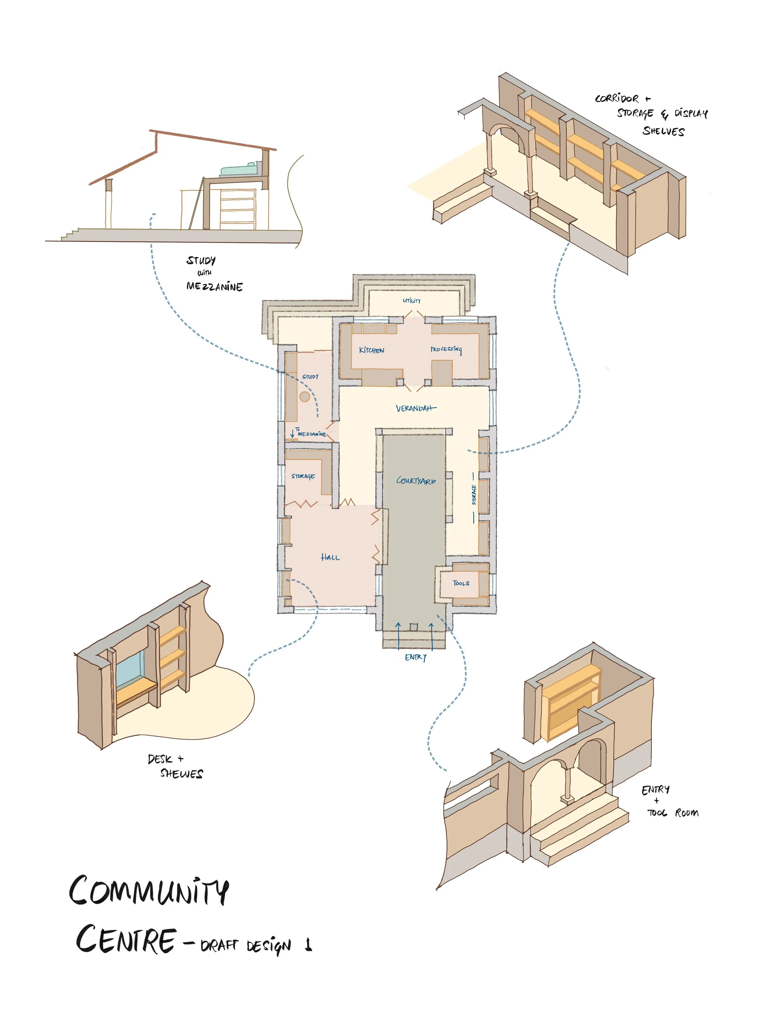
Draft layout
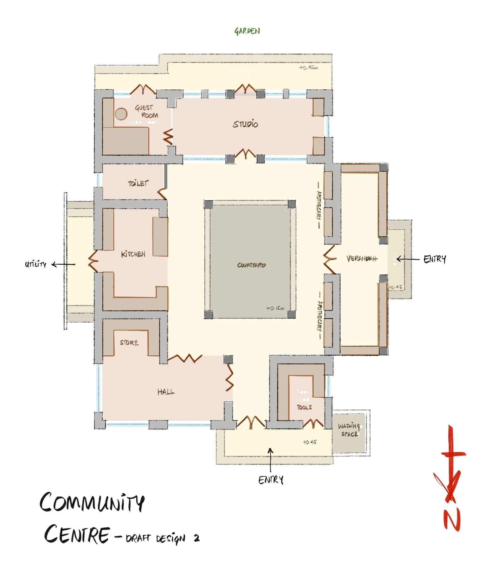
Final layout
Design for home + studio - site survey
The design evolved through a process that started with site selection within the 3-acre land based on various parameters, and the remote coordination of a bunyip survey (done by the clients, under the design team’s guidance) to assess the elevation of the site. A topographic analysis by a surveyor was tricky, owing to the steep slopes in some parts, and the dense forest on site. Based on the bunyip survey, the elevation of the selected site (along with existing trees) was mapped, which allowed for a more detailed and site-appropriate design.
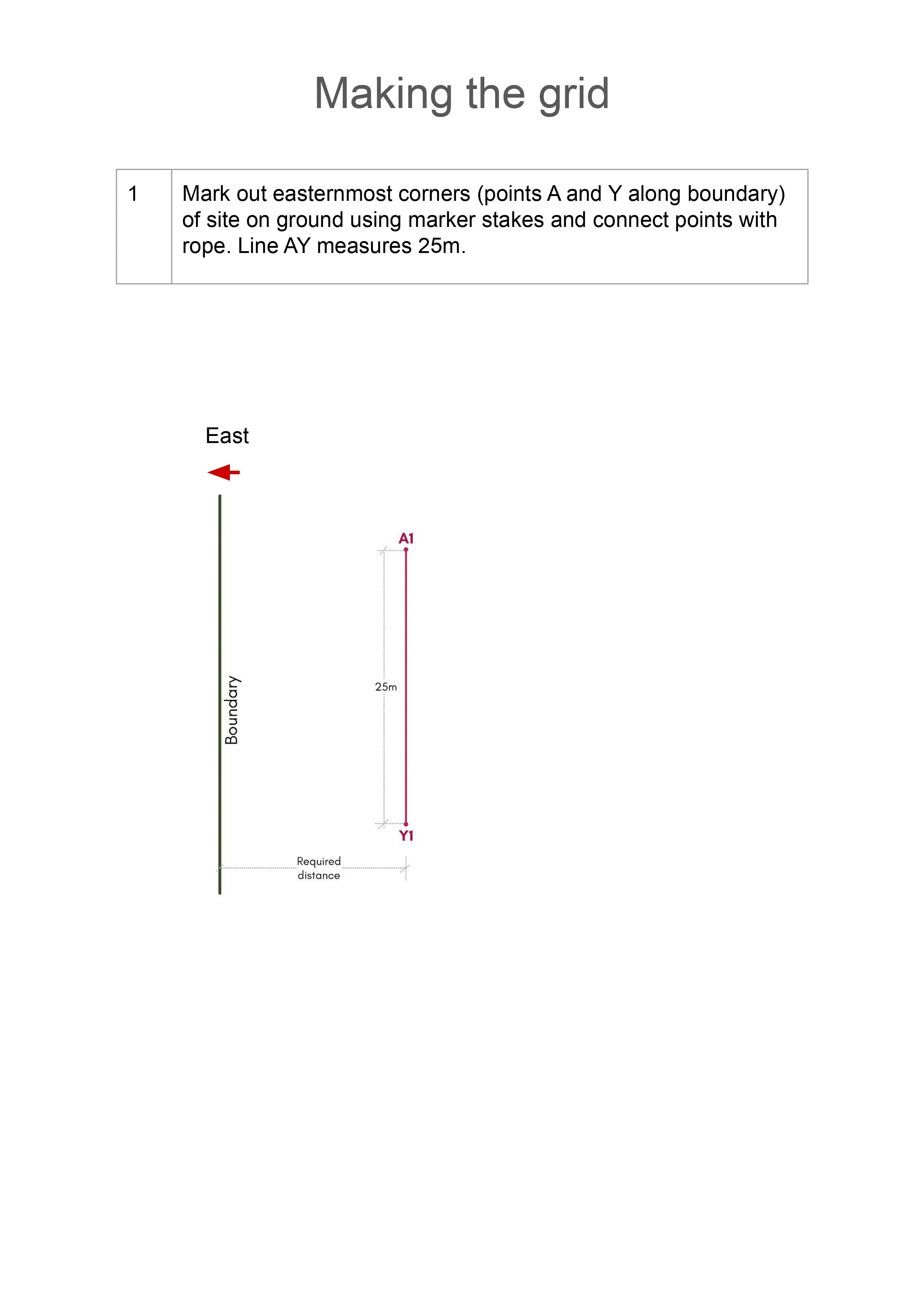
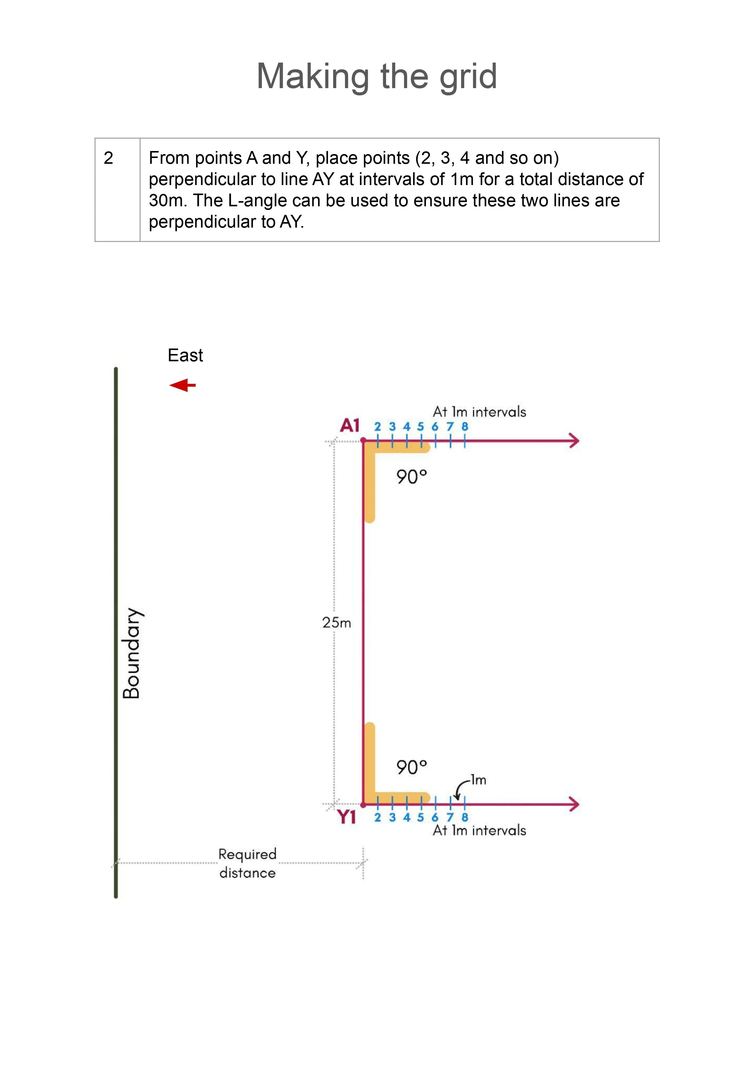
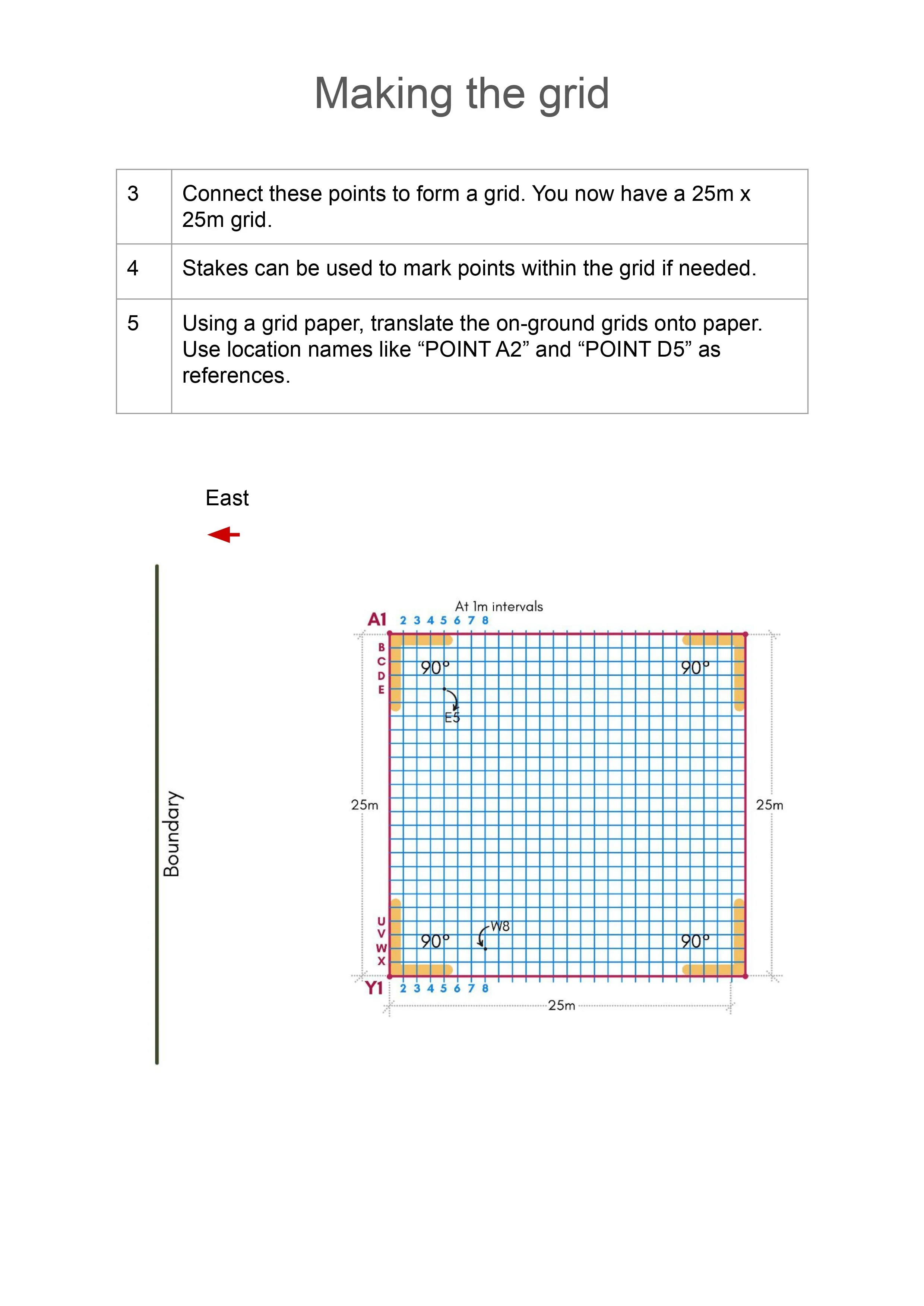
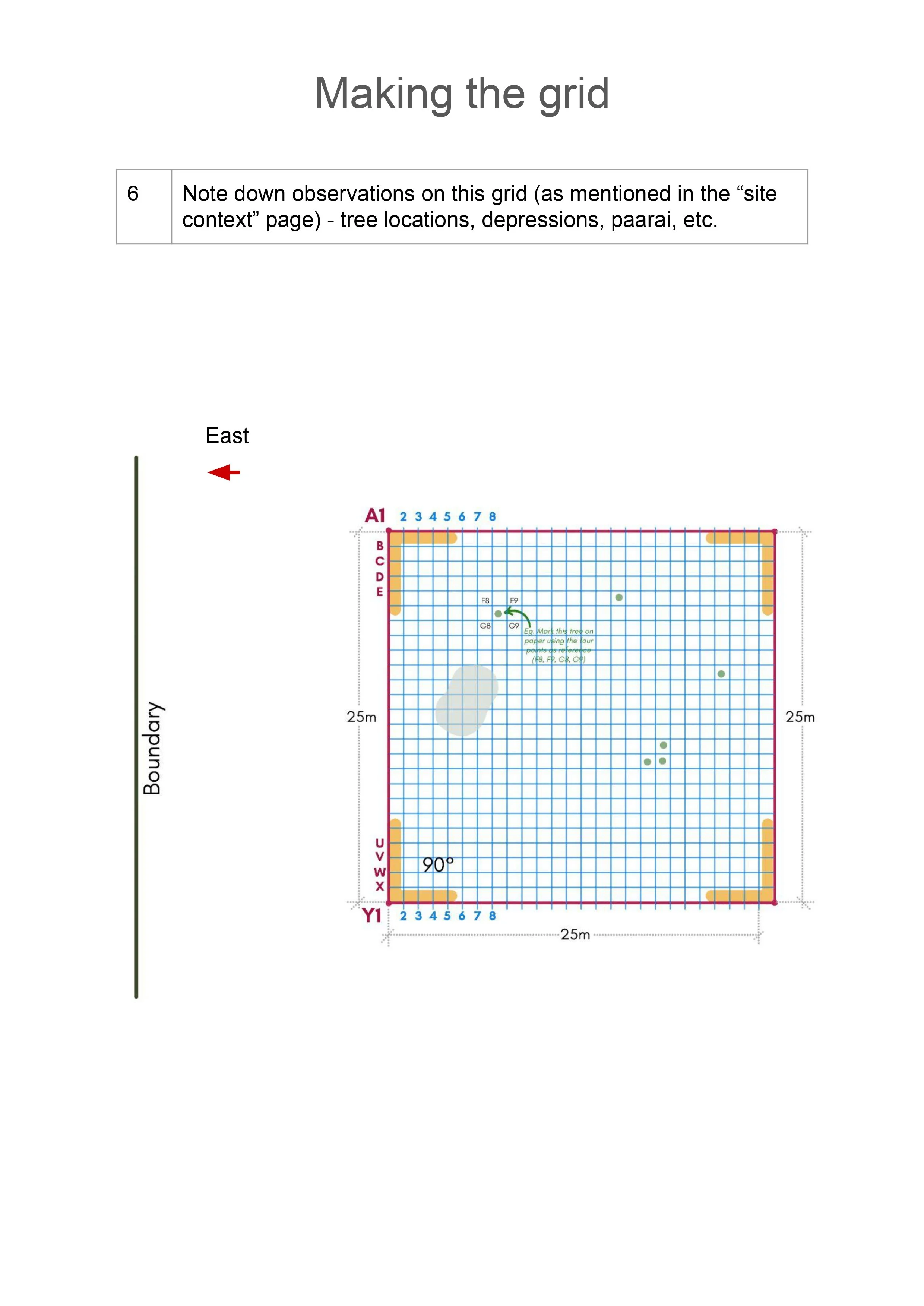
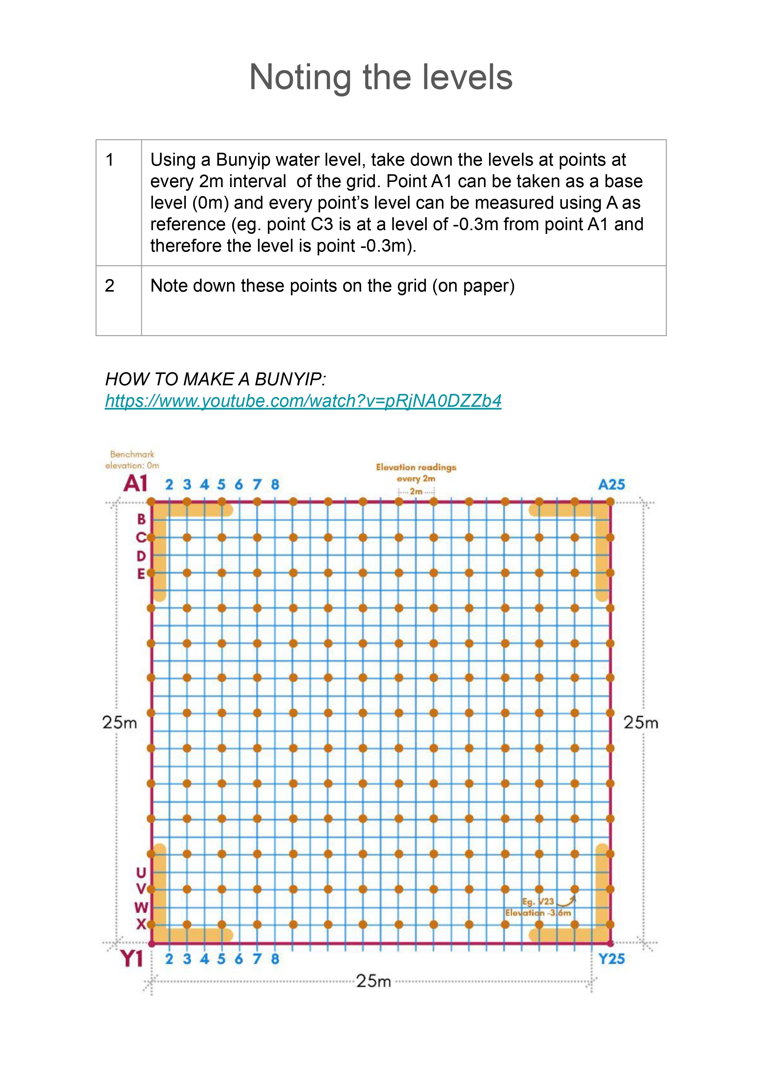
Remote coordination of site survey using a bunyip - marking the grid and noting levels
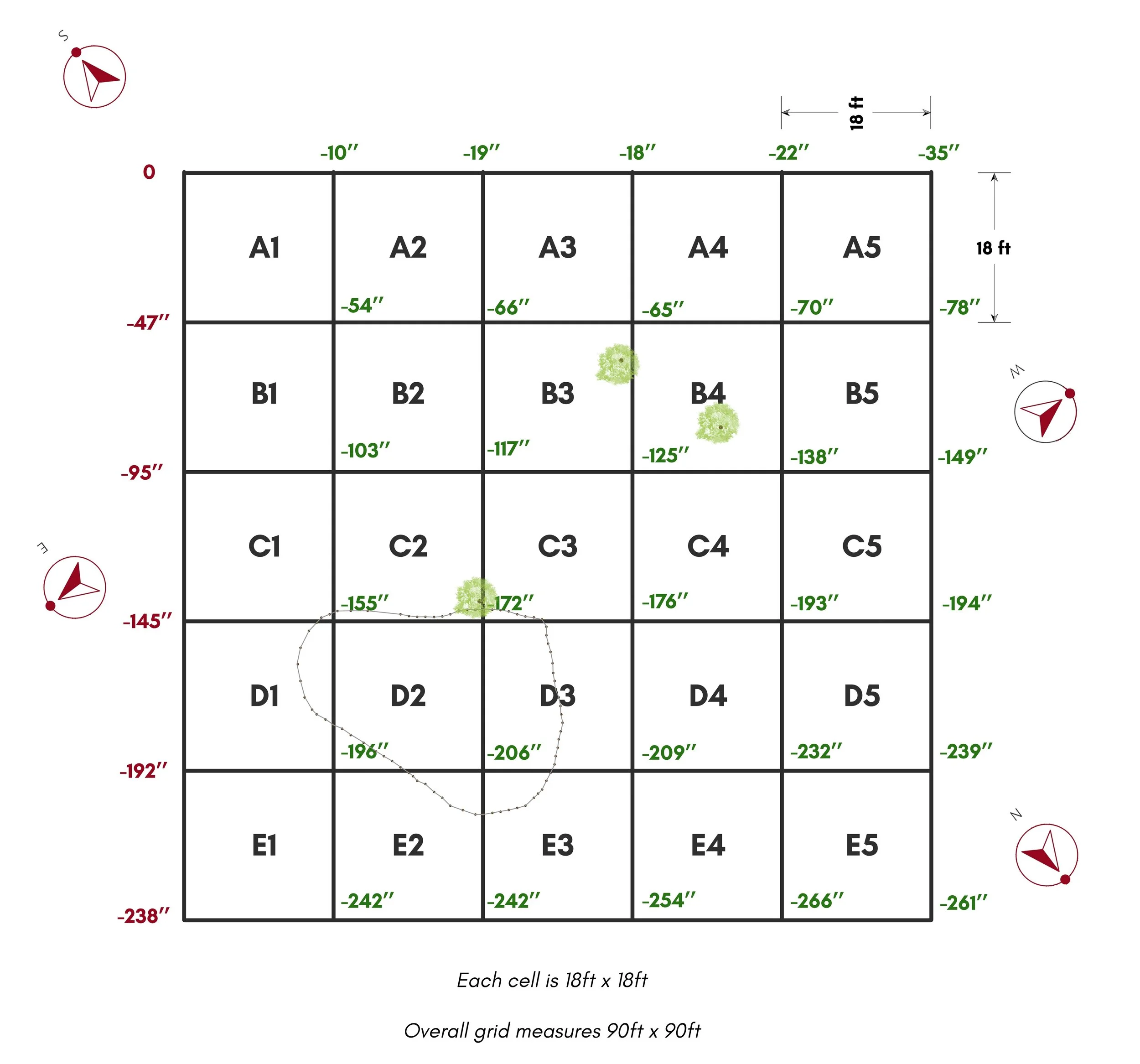
Final grid with elevation values and existing features like trees and rock outcrops
Design for home + studio
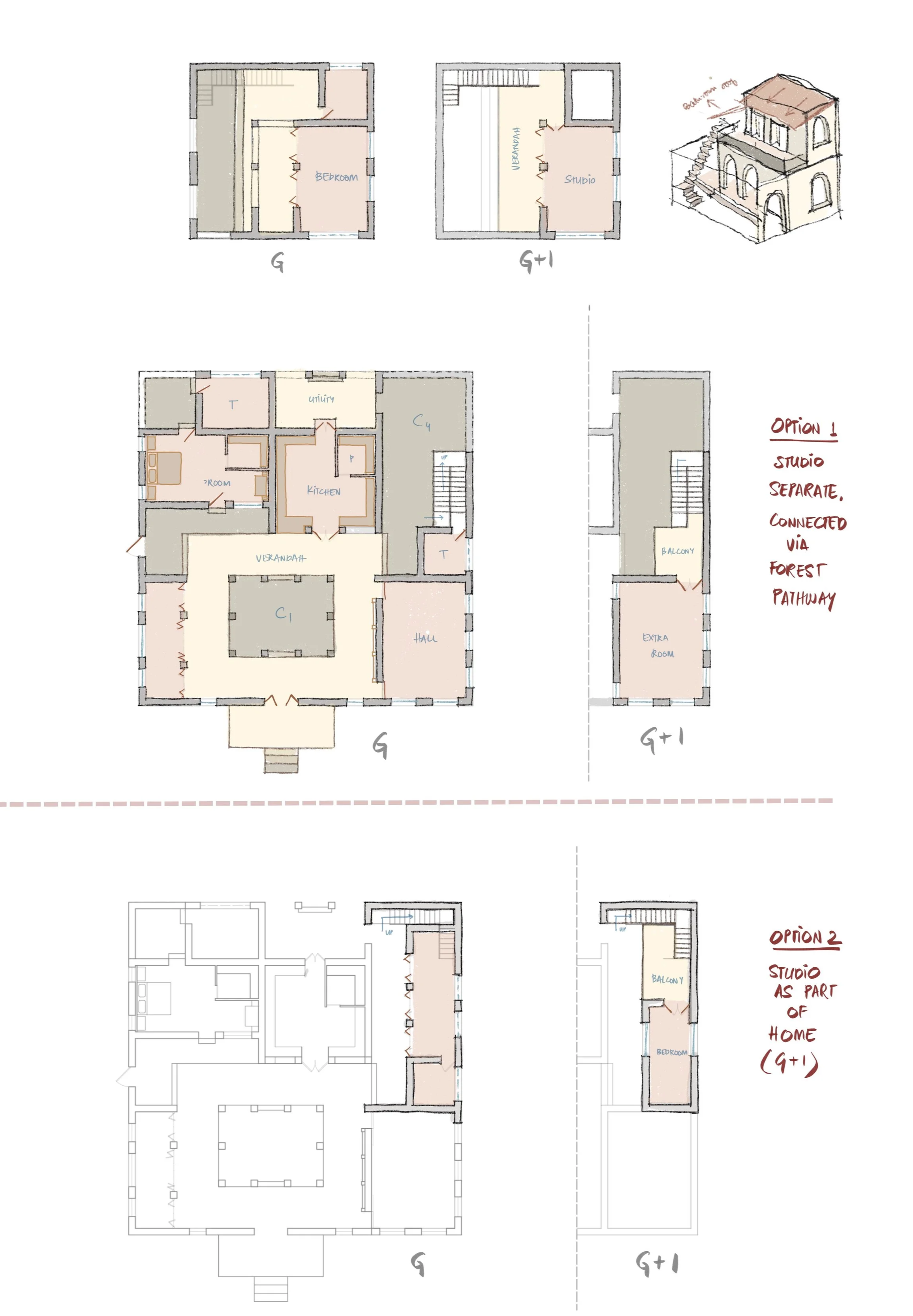
Draft layout 1
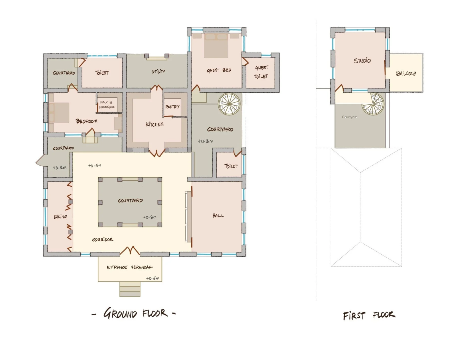
Draft layout 2
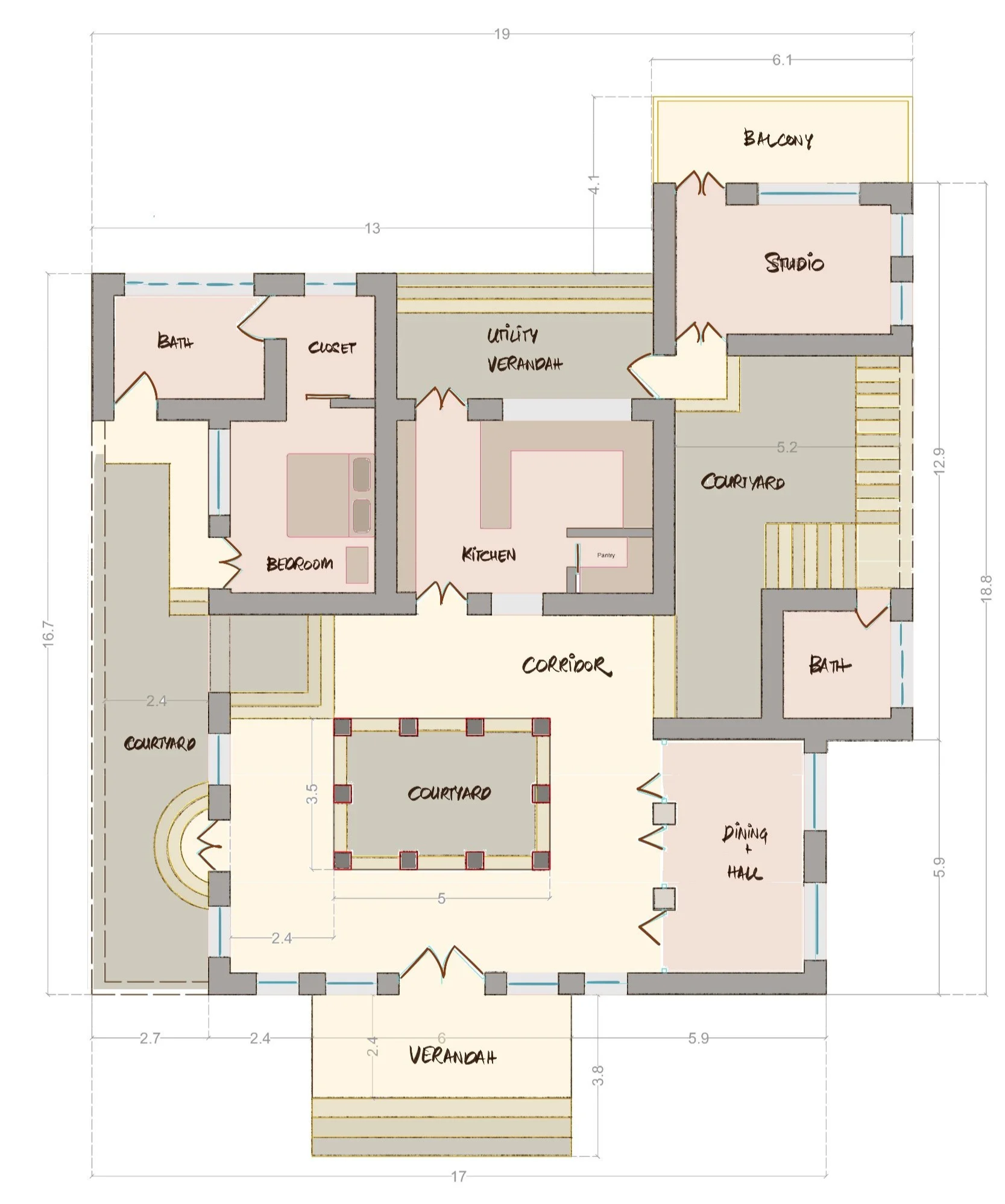
Draft layout 3
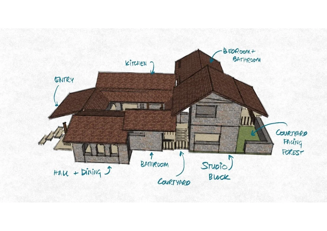
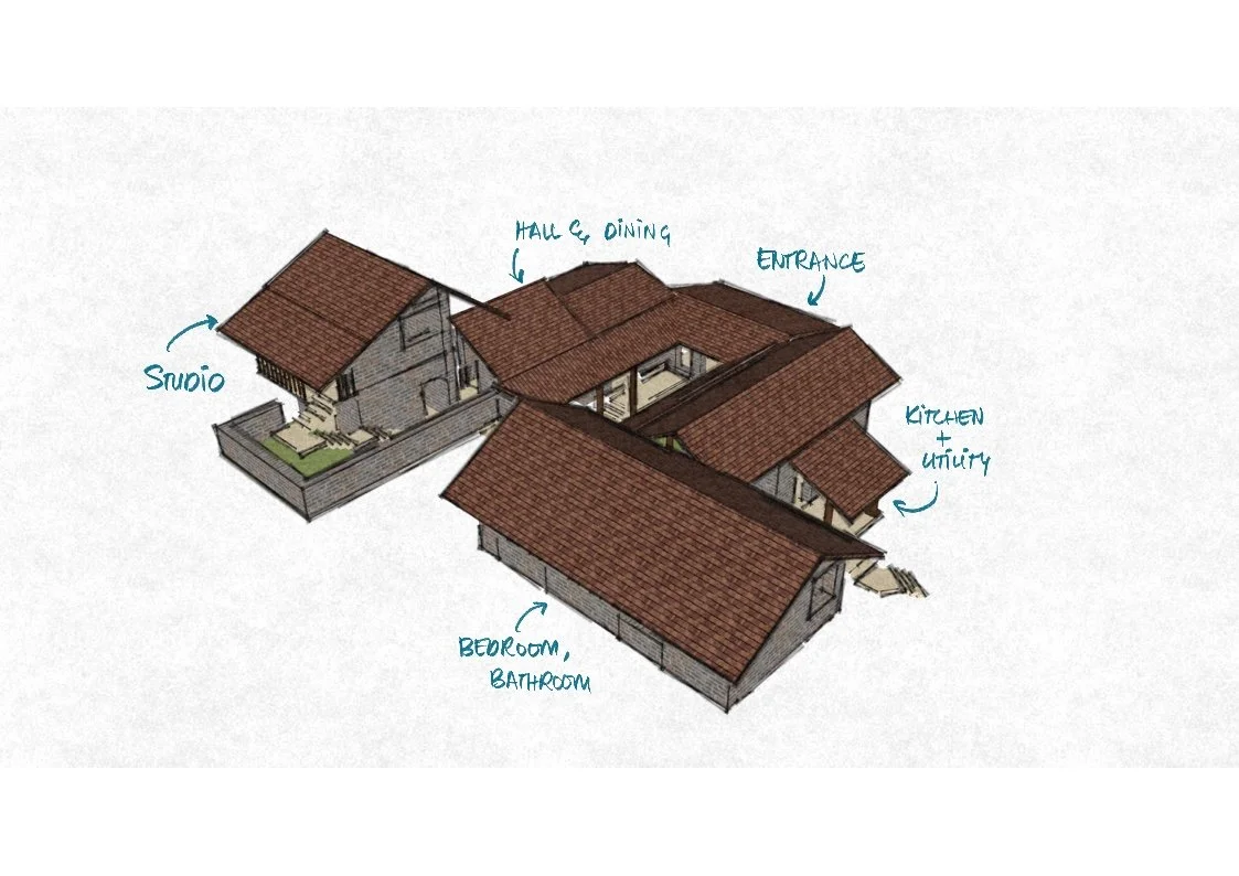
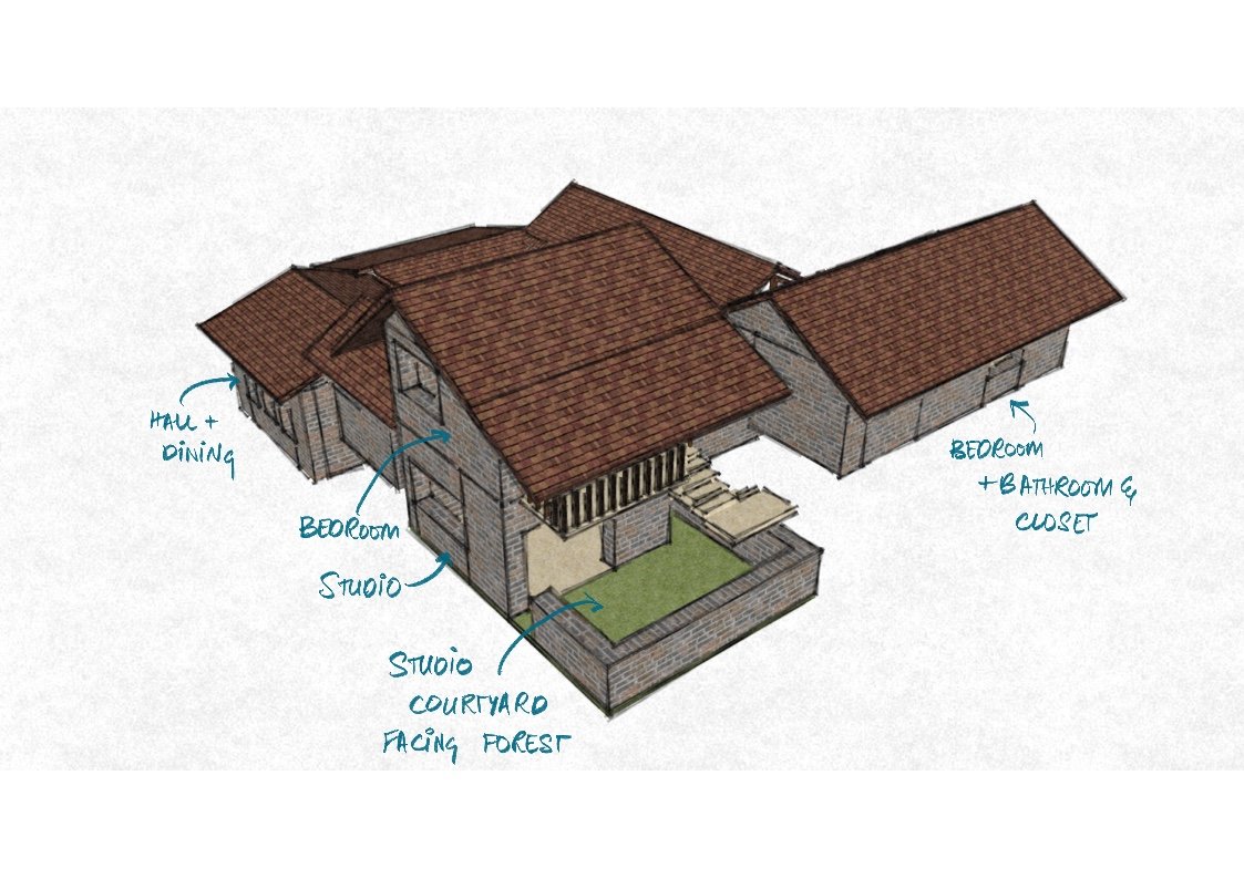
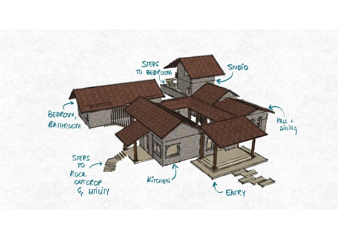
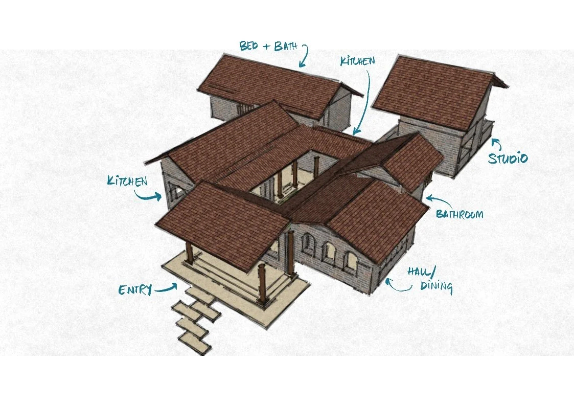
Final layout - 3D views
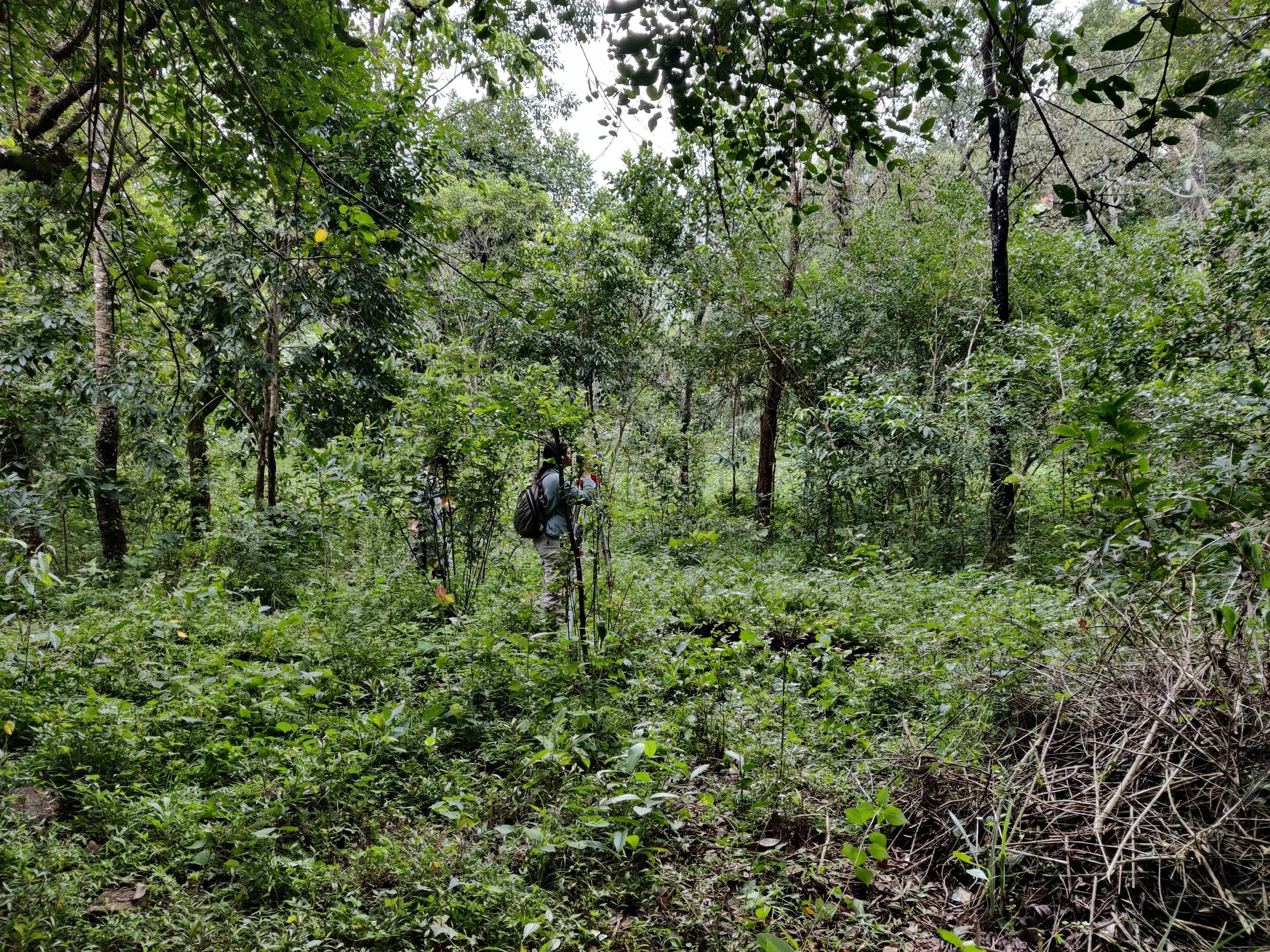
Site selection using auto level [photo by Theertha Ravindran]
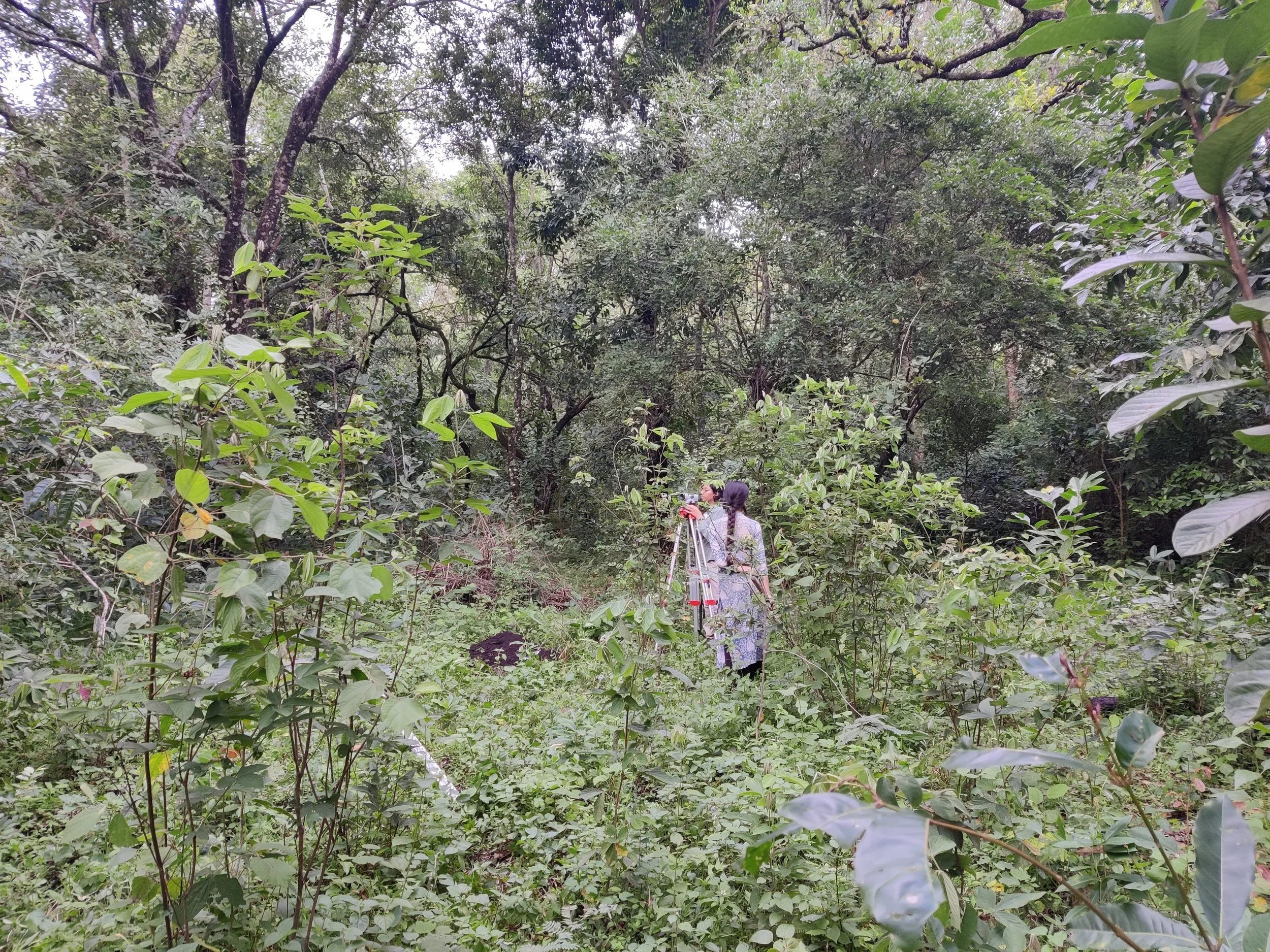
Site selection using auto level [photo by Theertha Ravindran]
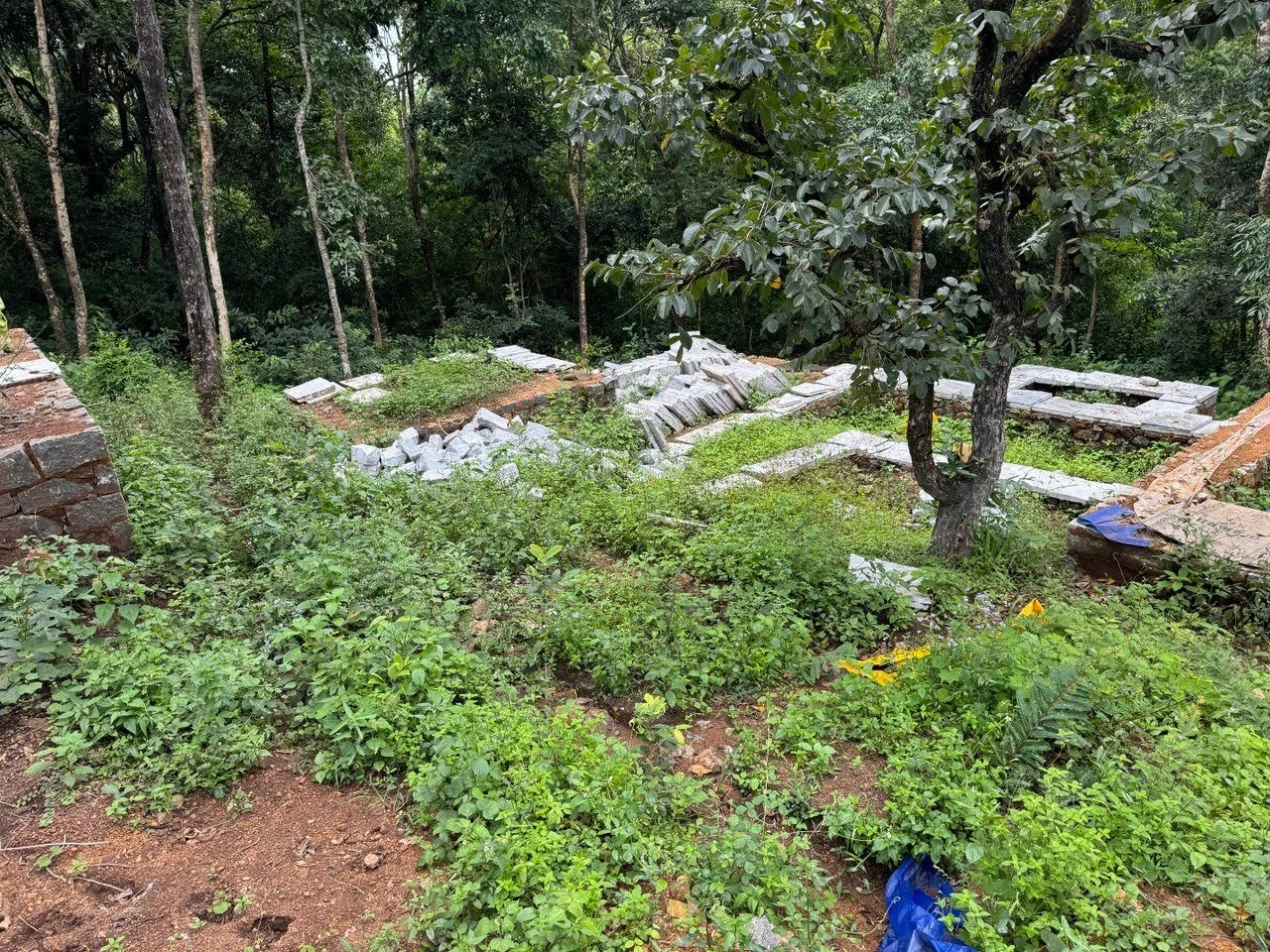
Plinth work in progress [photo from clients]
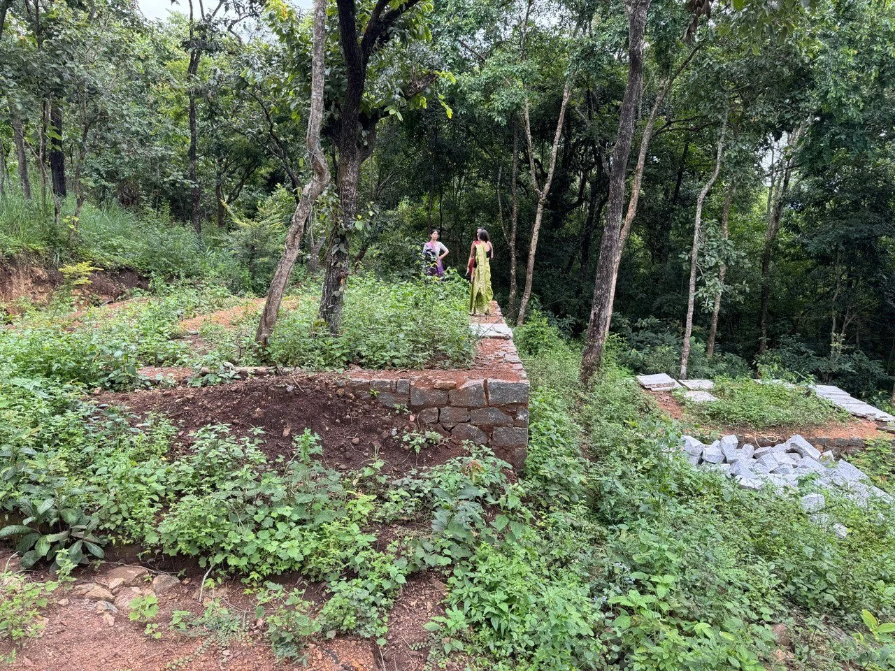
Plinth work in progress [photo from clients]