Kongavalli Farm
Regenerative design and turnkey execution
September 2023 - August 2024
with Ananas Design
Role: Project lead
Collaborators: Himanshu Arteev, Joshua Danesh
Field work collaborators: Theertha Ravindran, Varun Behroonani, Jananee Mohan
Western Ghats buffer zone, between Sakleshpur and Hassan, Karnataka, IN
8.9 acres | 980m ASL
Tropical savanna climate
912 mm annual rainfall | Sandy loam
North Western Ghats moist deciduous / South Deccan Plateau dry deciduous forest
DESIGN PHASE
Masterplan (drafted by Joshua Danesh)
Earthworks Map (drafted by Joshua Danesh)
This 8.9-acre land lay in the transition zone between the Deccan Plateau and the Western Ghats, near Sakleshpur, Karnataka. The site was abutted by a seasonal steep with a steep drop, dominated by invasive species and had ongoing intensive areca cultivation. The vision for the design was species diversification, biodiversity restoration, regenerative agroforestry and water management.
This was achieved through the design of a series of interconnected earthworks - basins, ponds, bio swales, swales and cascading pools. This was supported by biomass planting across site, as well as the design of planted zones like food forests, living fences, pollinator gardens and wild zones. The existing areca zone was diversified into a syntropic agroforestry area.
ON-GROUND IMPLEMENTATION
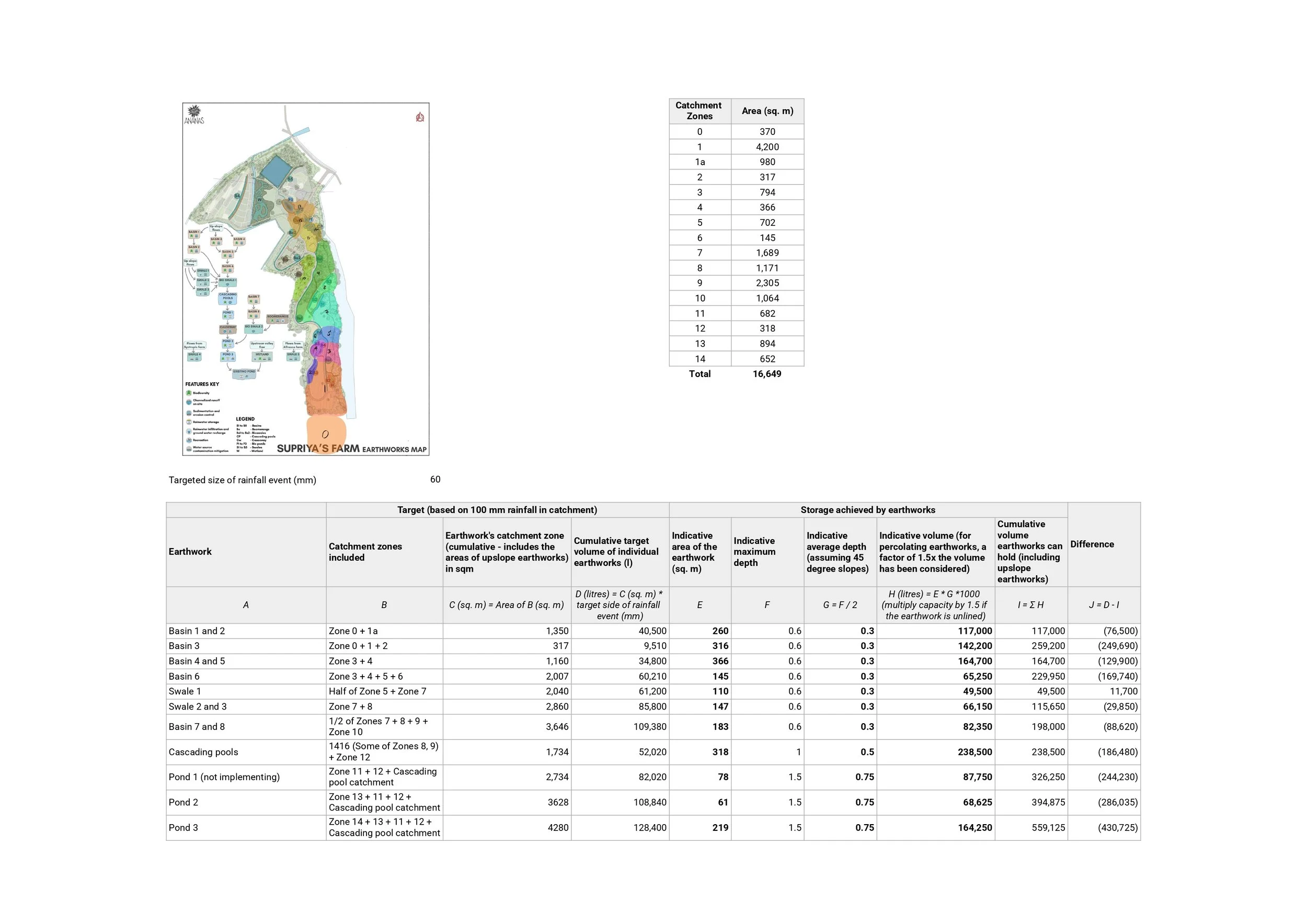
Capacity planning for volume calculations and earthworks design
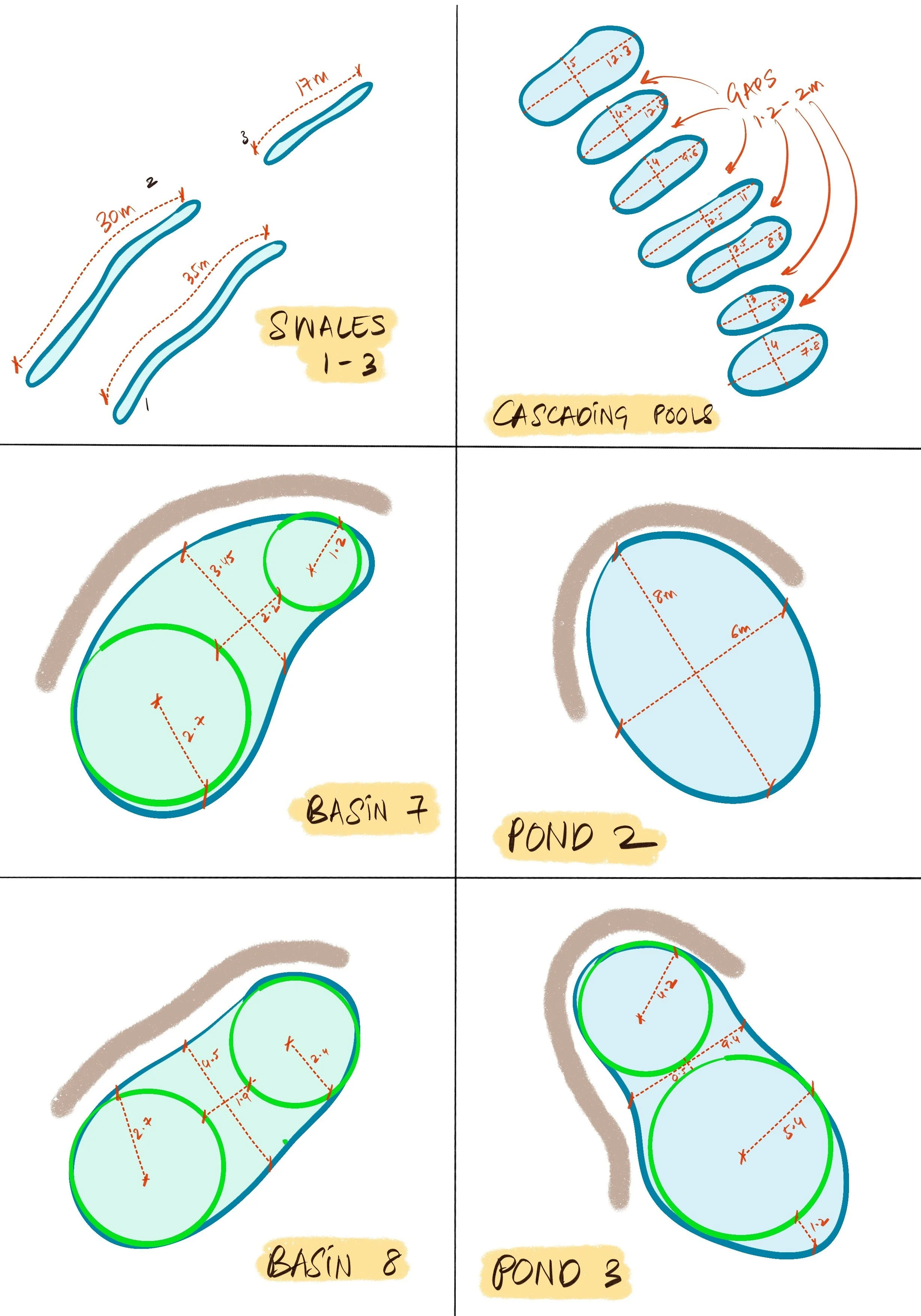
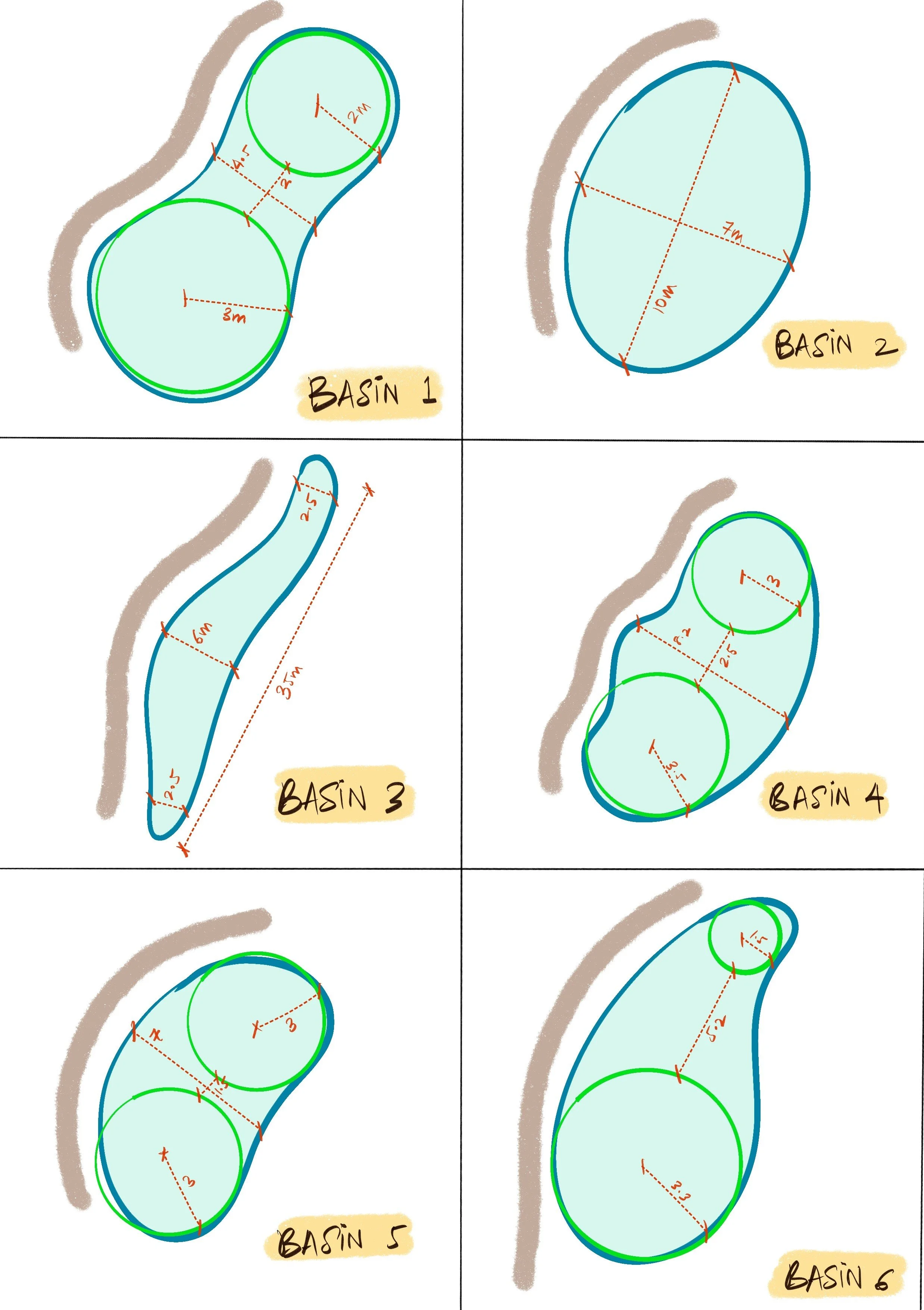
Detailed design for earthworks
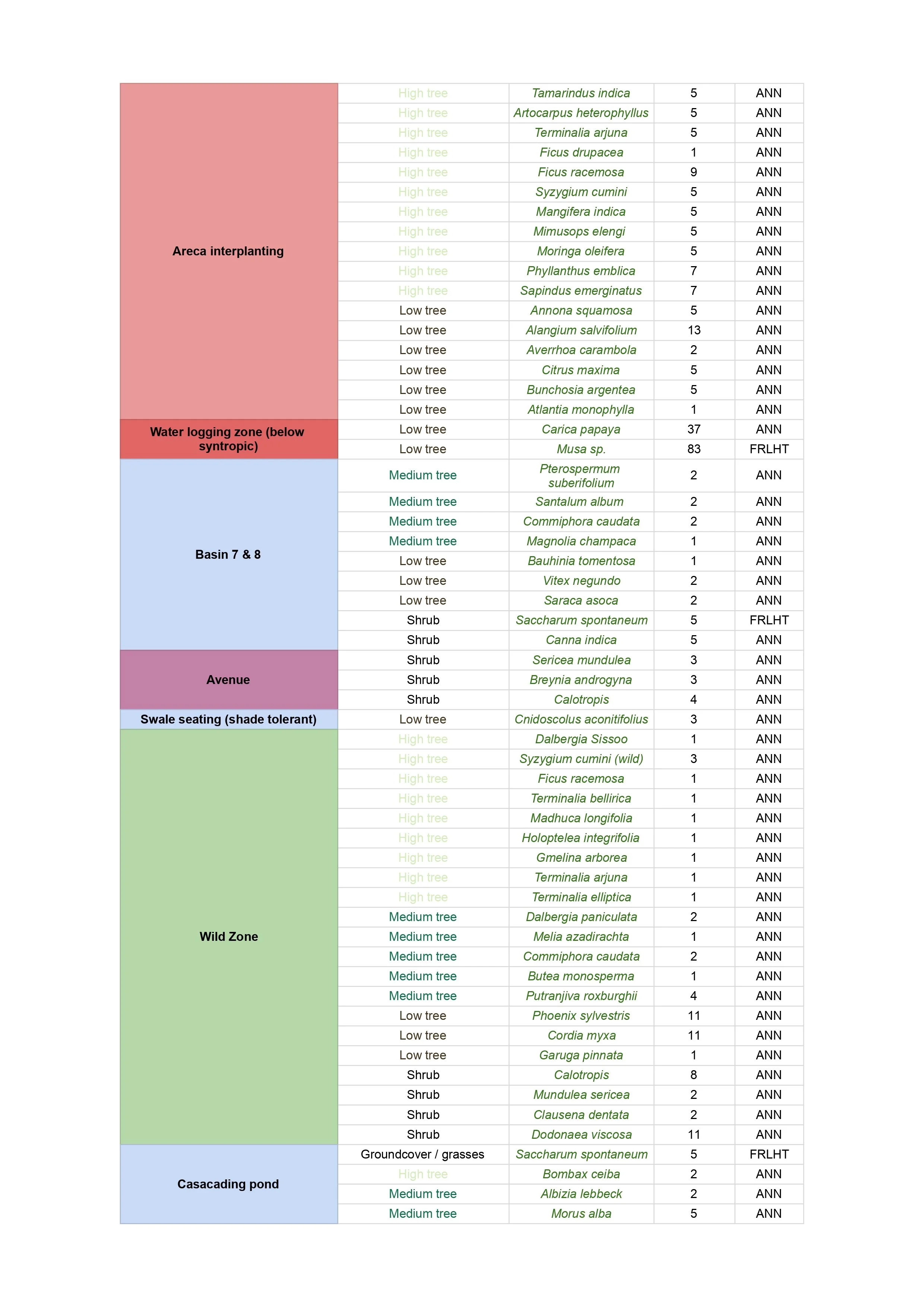
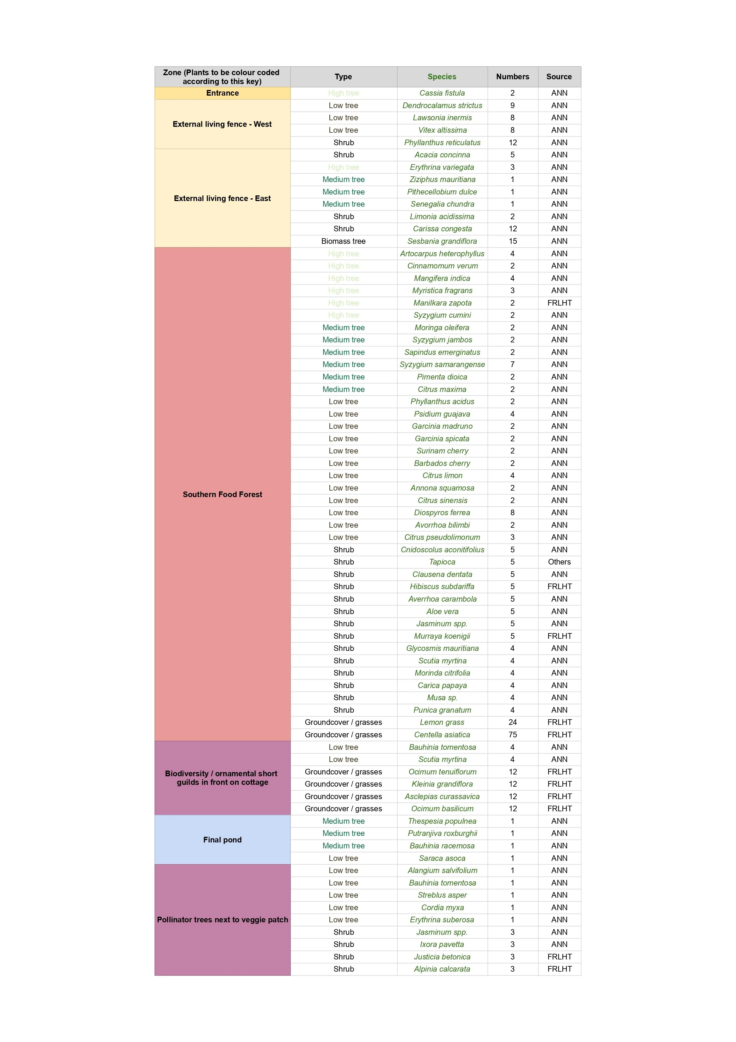
Plant lists (by Varun Behroonani)
To bring the design to life, the team managed the turnkey implementation for earthworks and planting, over multiple site visits. This included day-to-day task planning and supervision; on-site coordination of materials and machinery; demonstrations of the work for the workforce; procurement of tools, seeds and saplings; and communications with the caretaker and clients. This was supported by pre- and post-visit tasks such as capacity planning for earthworks, preparation of plant lists and the creation of marking drawings / detailed drawings for implementation.
IMPLEMENTATION PHOTOS
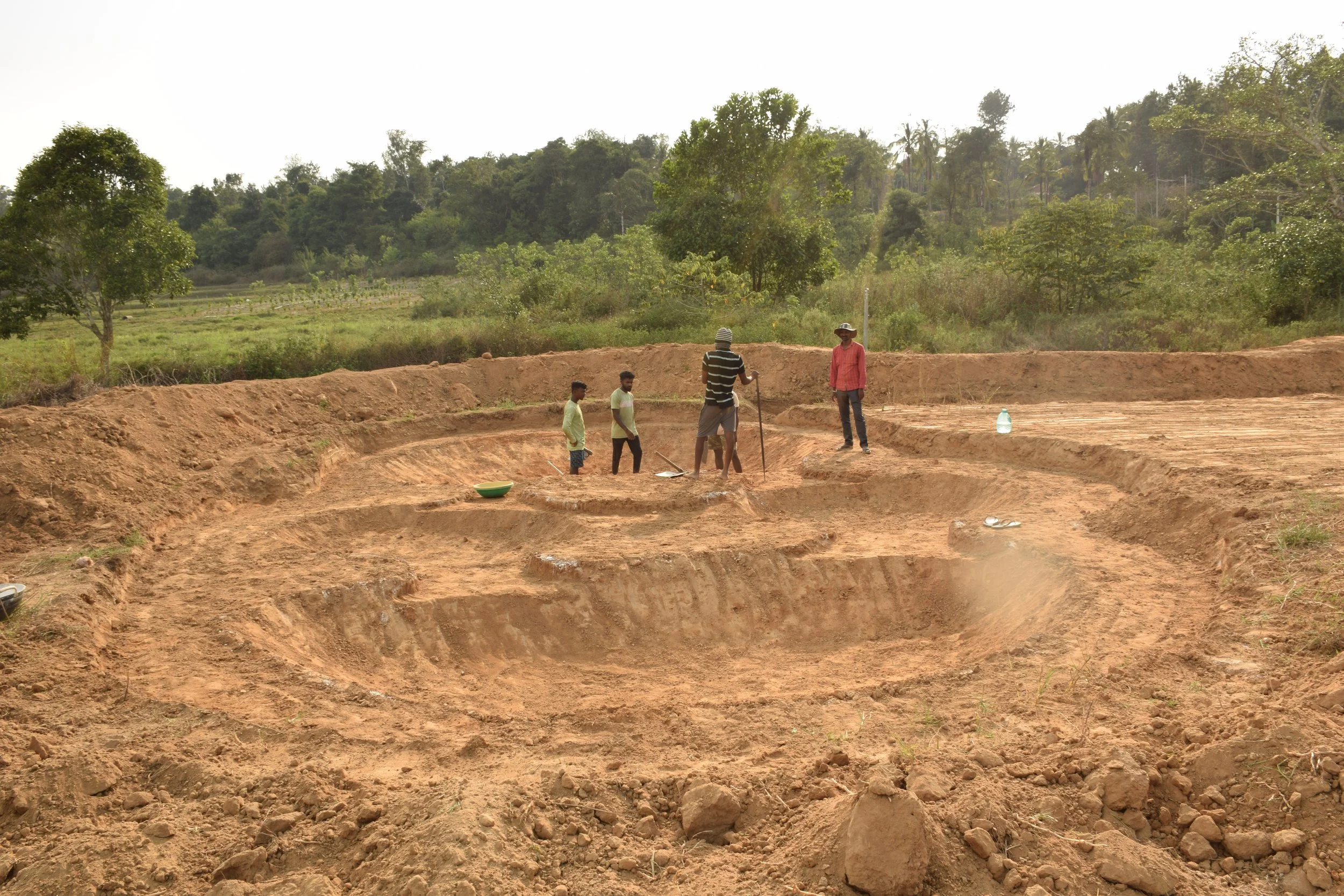
Pond 3 with varying levels [photo by Theertha Ravindran]
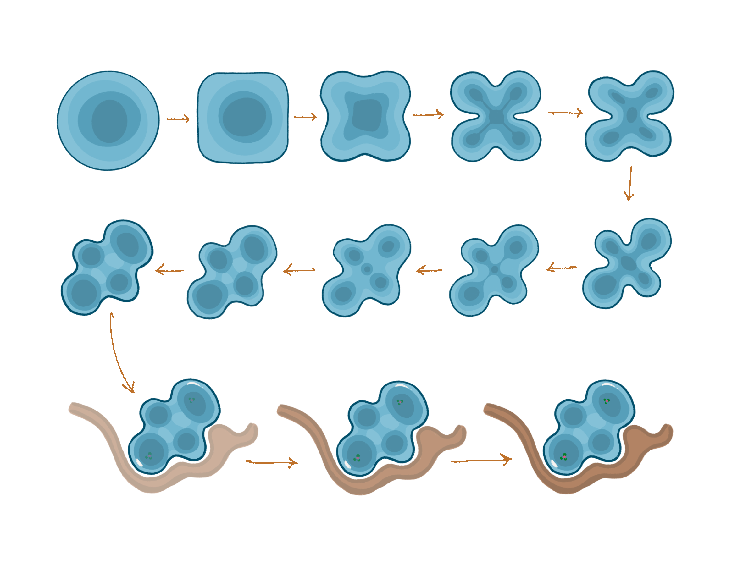
Evolution of Pond 3's shape
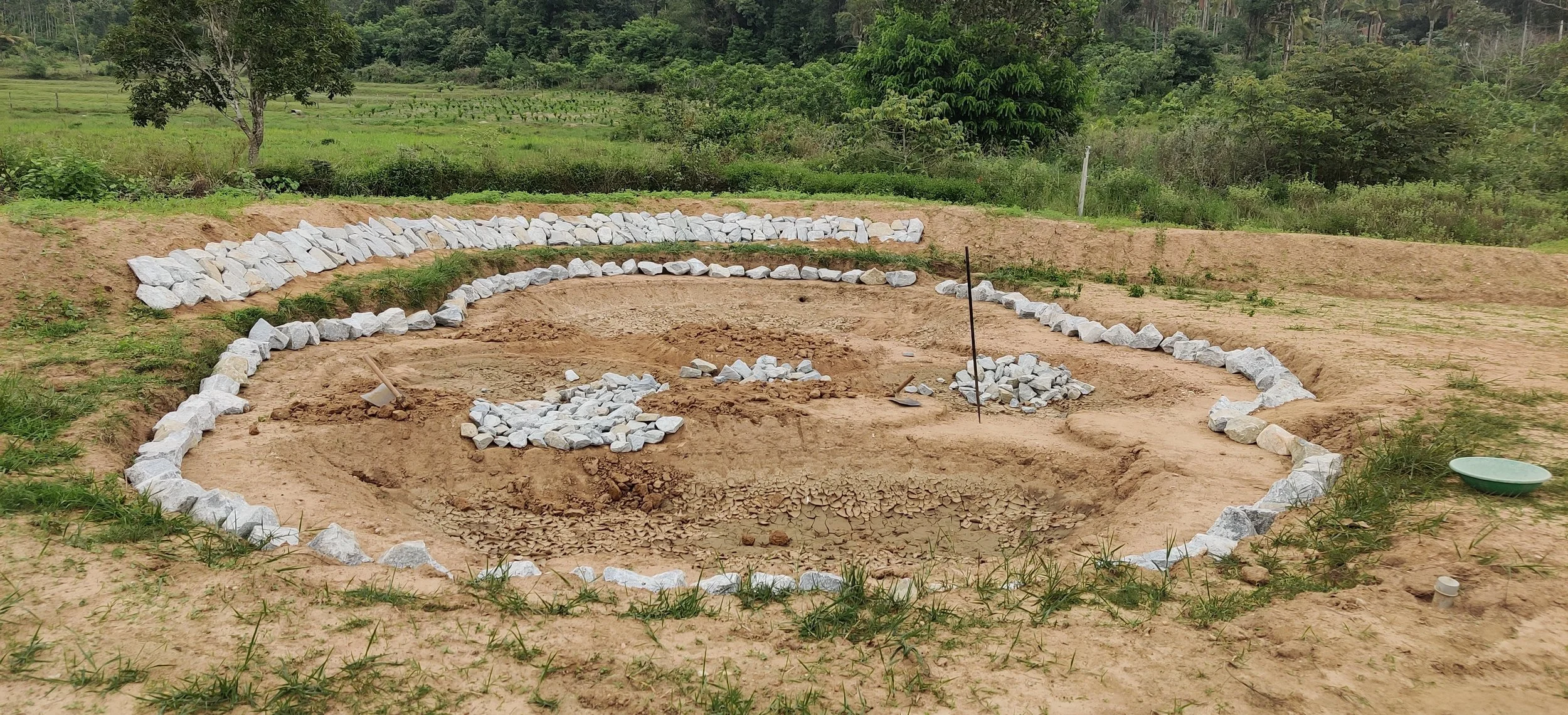
Pond 3 edges retained with rock [photo by Jananee Mohan]
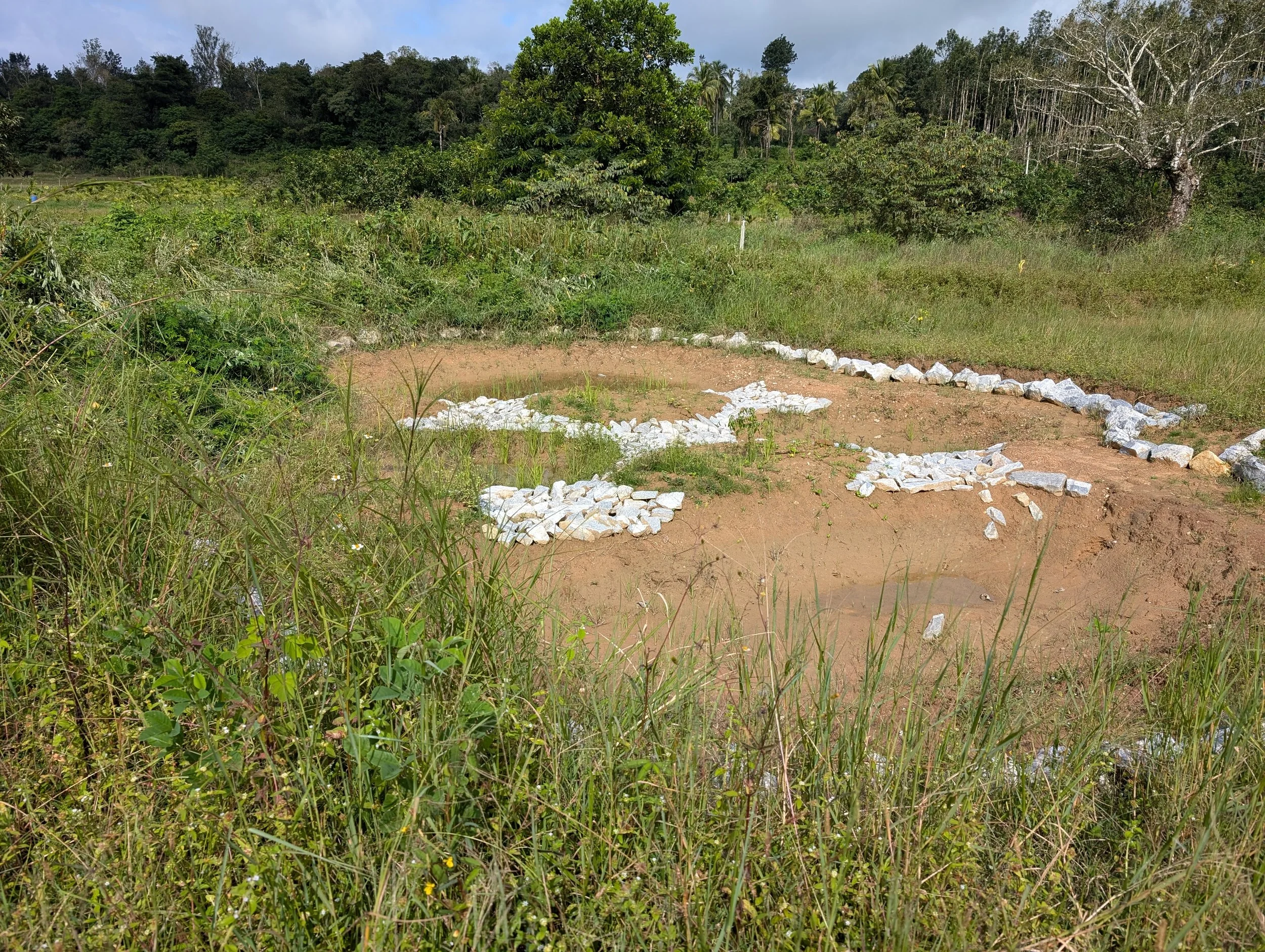
Pond 3 after a monsoon [photo by Theertha Ravindran]
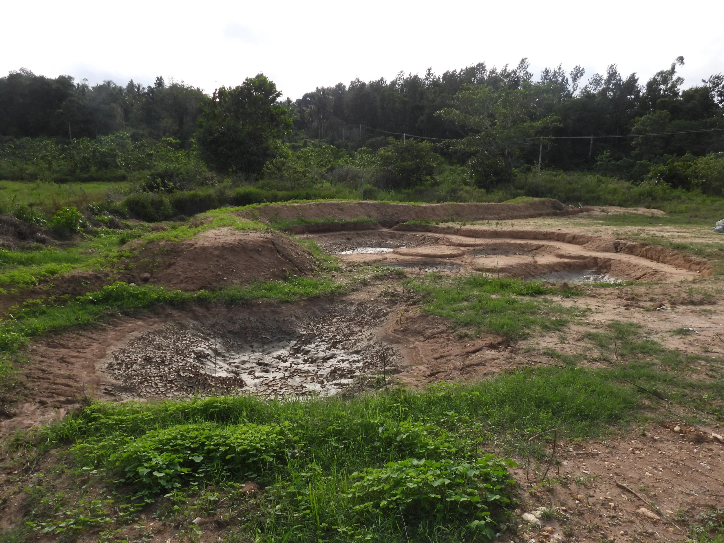
Pond 3 after a monsoon [photo by Jananee Mohan]
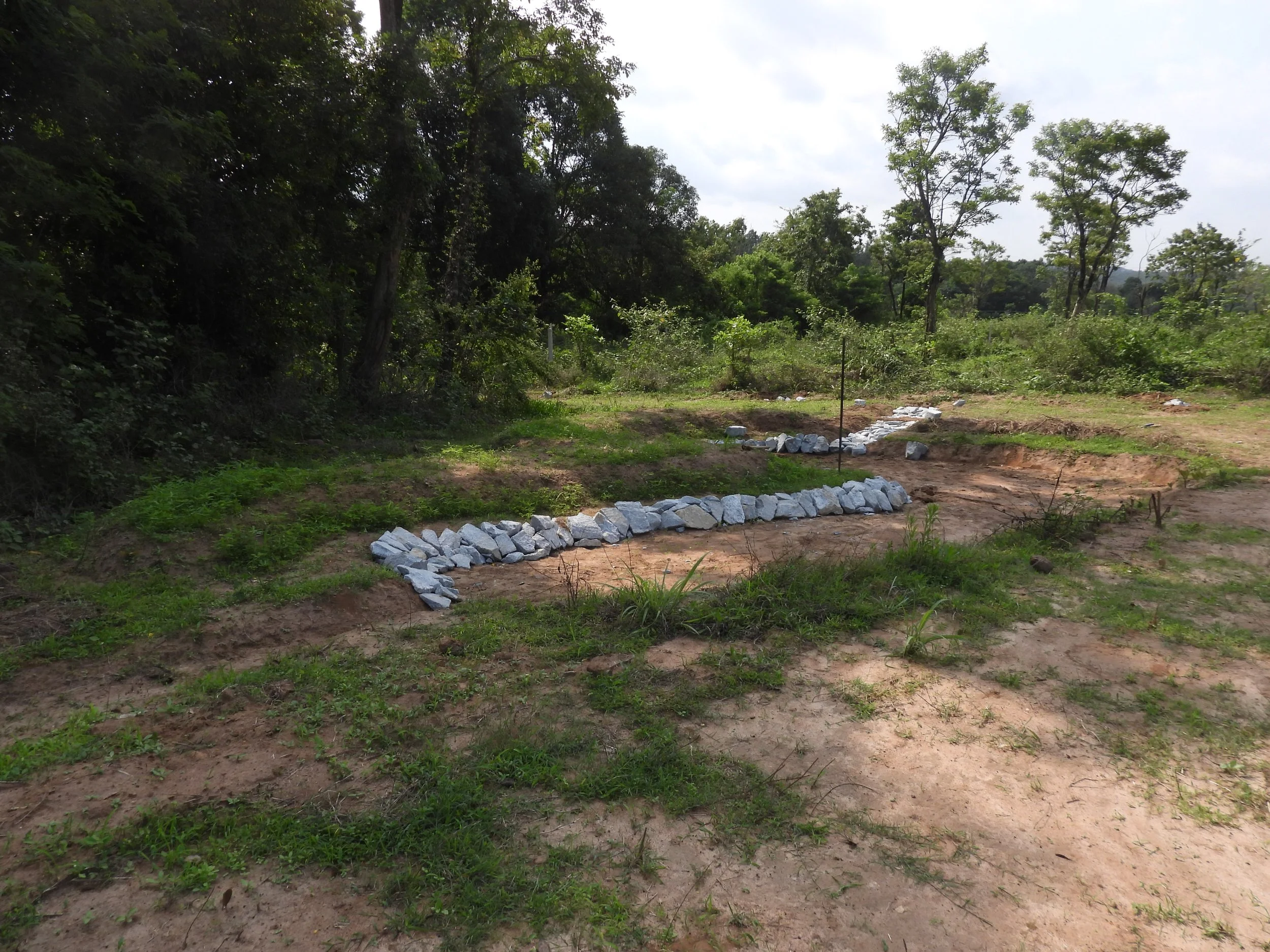
Basin 6 after digging and retaining bund with rocks [photo by Jananee Mohan]
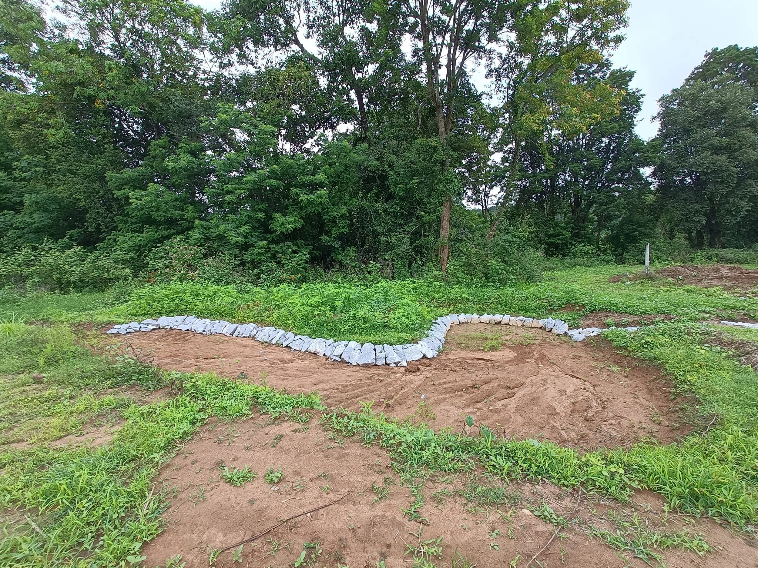
Basin 6 after digging + one rain
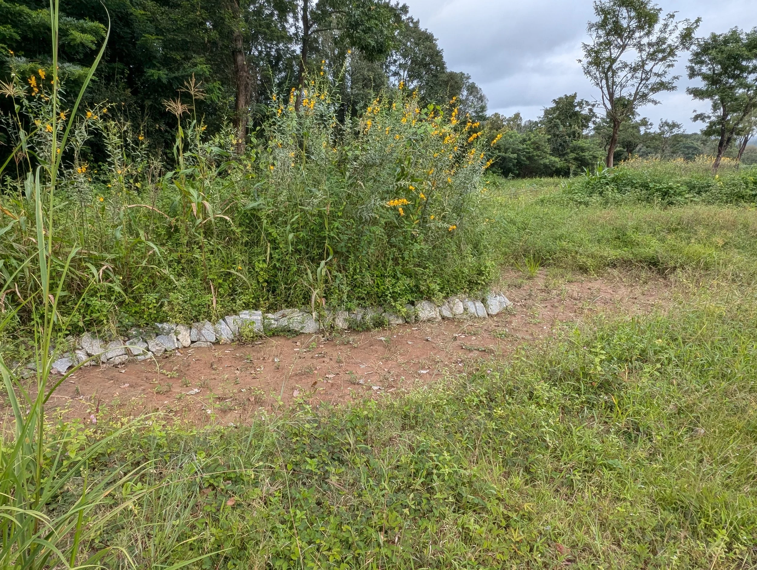
Basin 6 after 2 months [photo by Theertha Ravindran]
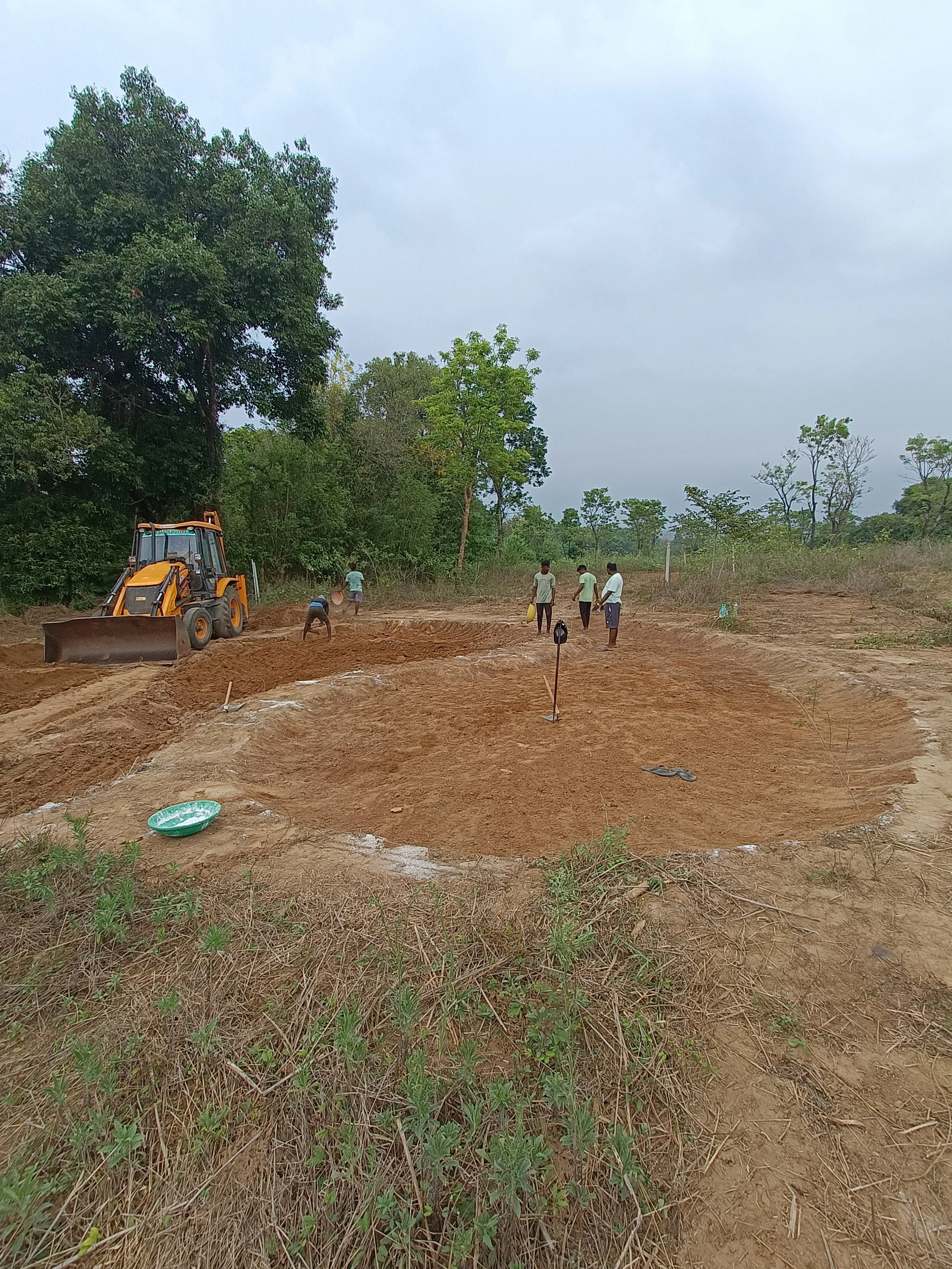
Basin 4 and 5 (freshly dug and shaped)
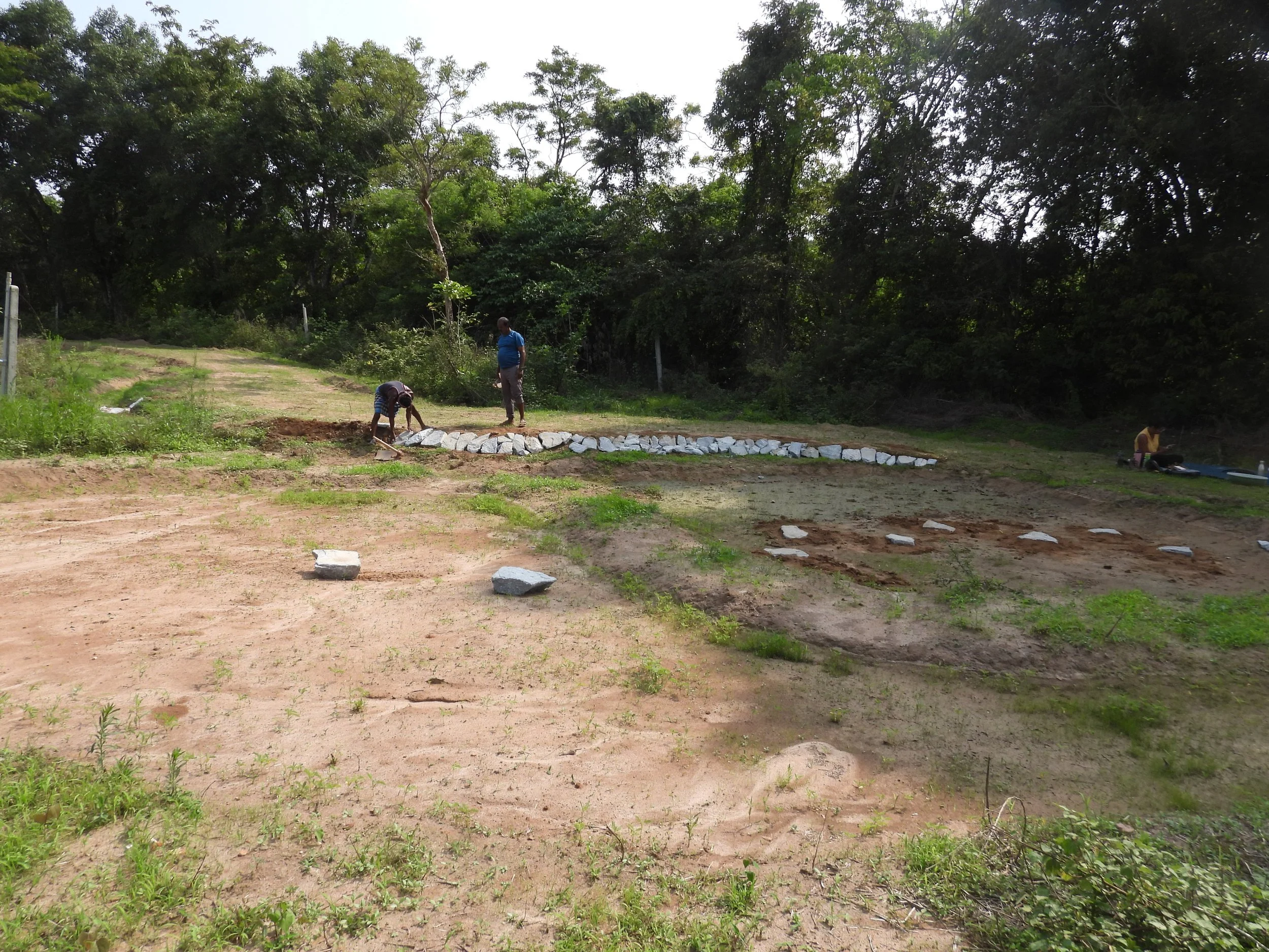
Basin 4 and 5 with stepping stones, and raised road retained with rocks [photo by Jananee Mohan]
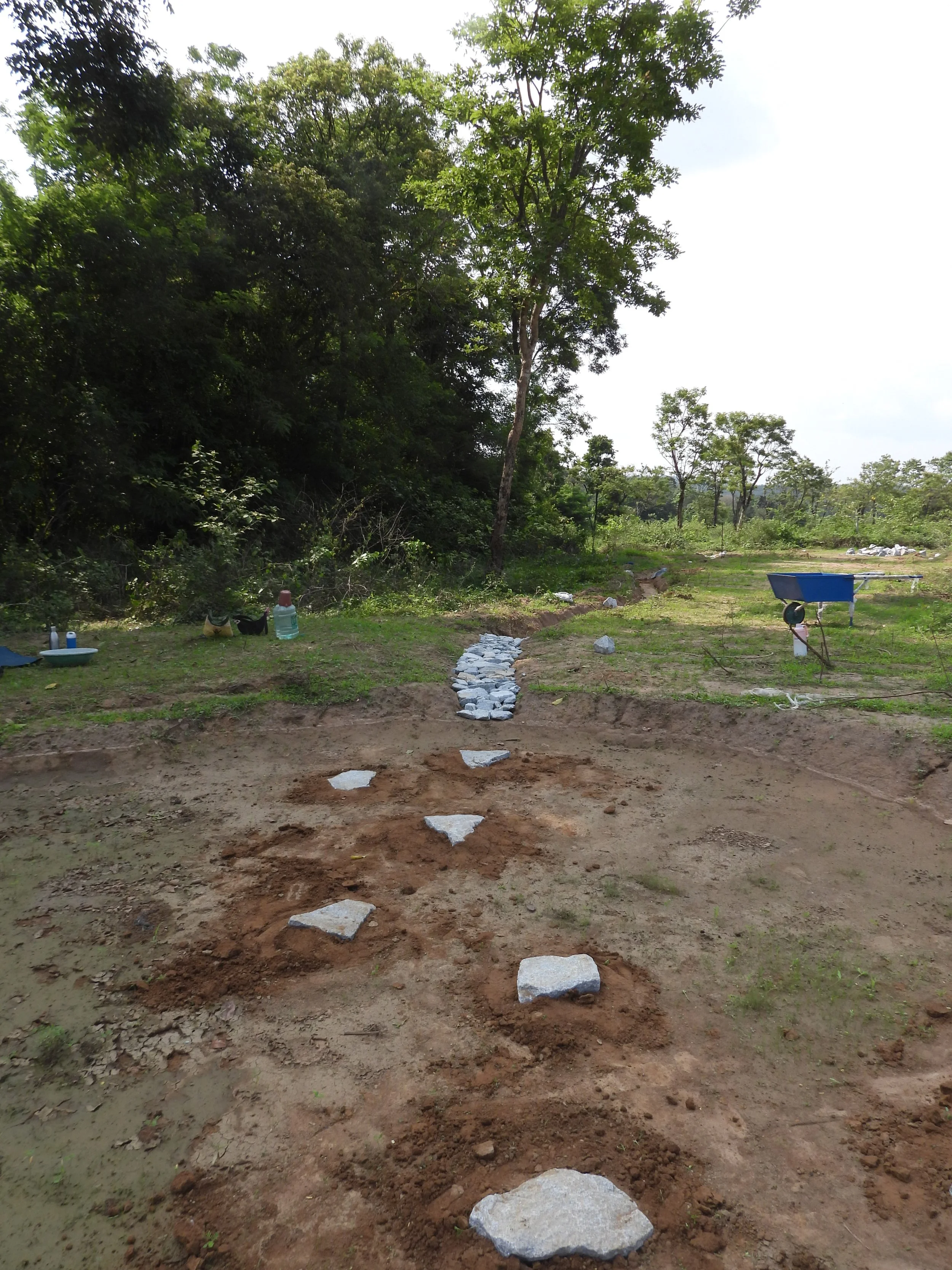
Basin 4 and 5 with stepping stones [photo by Jananee Mohan]
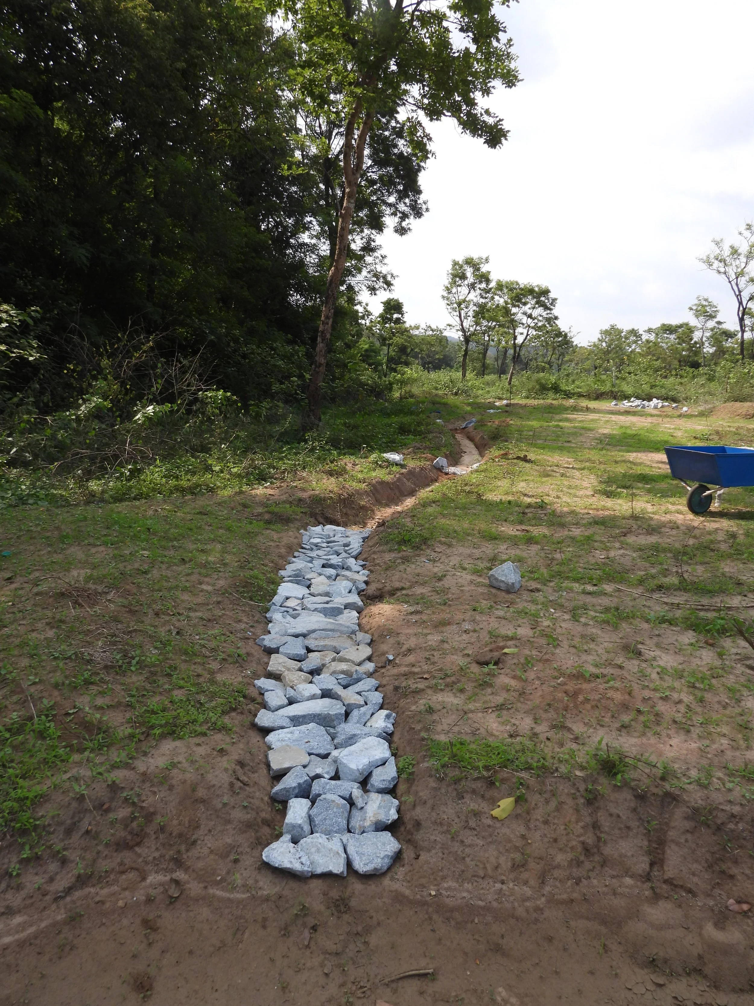
Inlet lined with rocks [photo by Jananee Mohan]
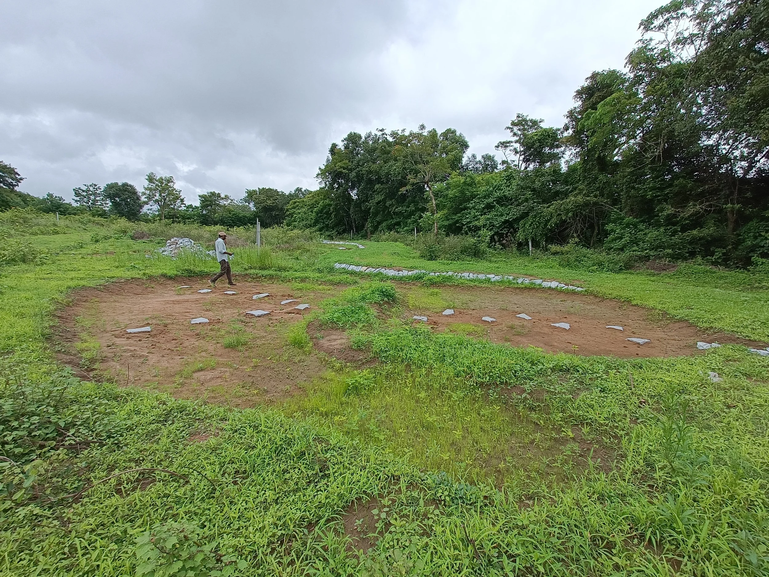
Basin 4 and 5 after one rain
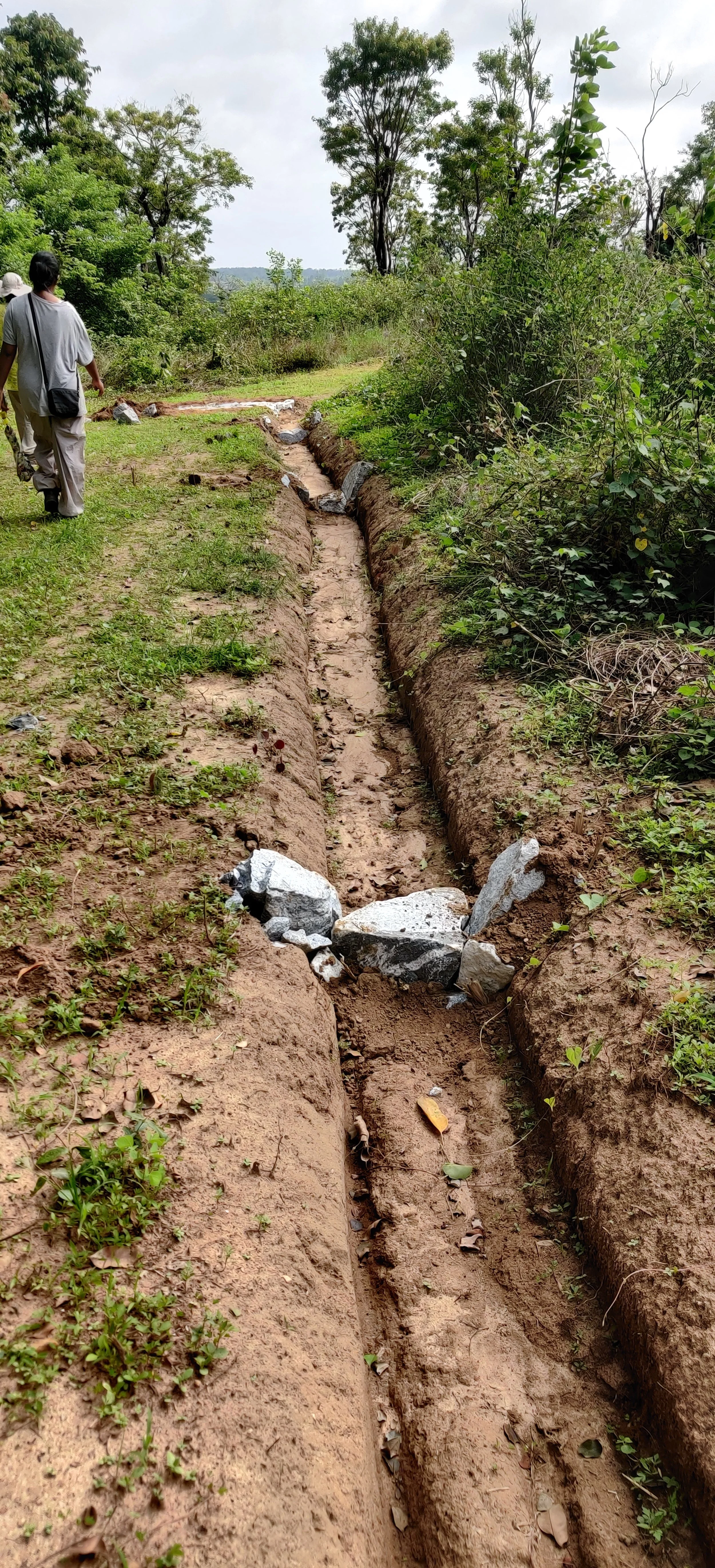
Bioswale with one-rock-dam [photo by Jananee Mohan]
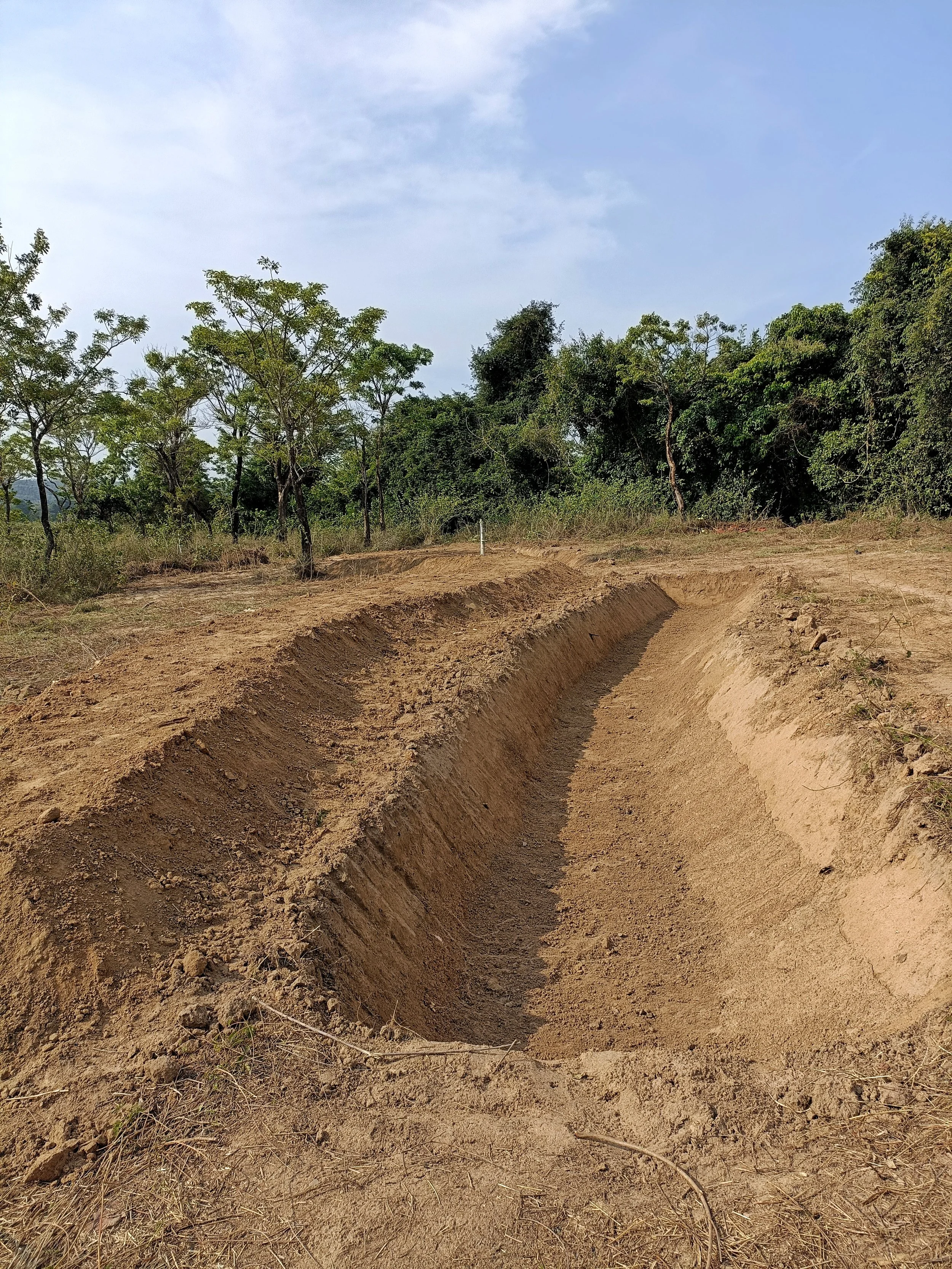
Swale and bund to slow runoff
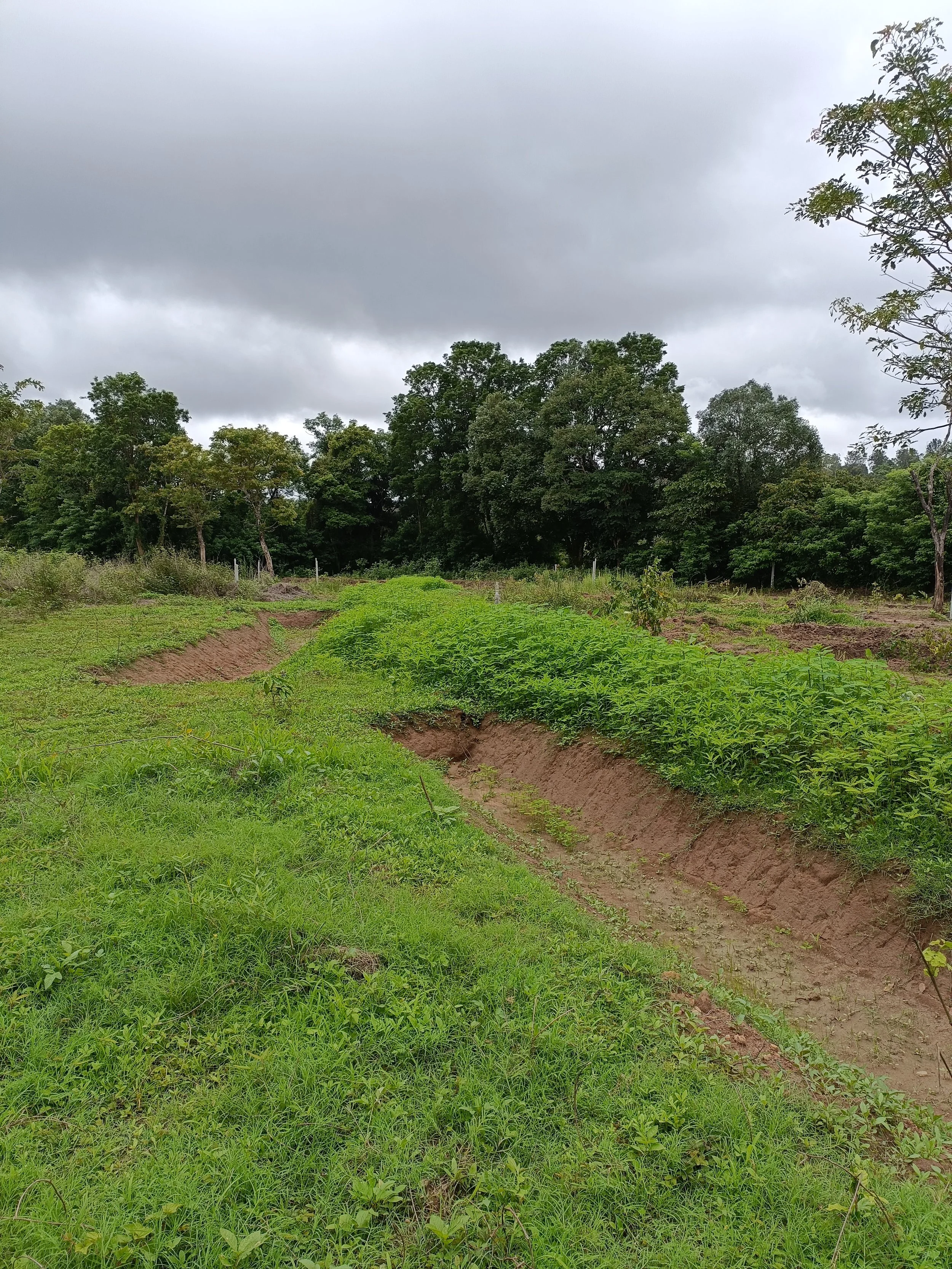
Swale and bund after one rain
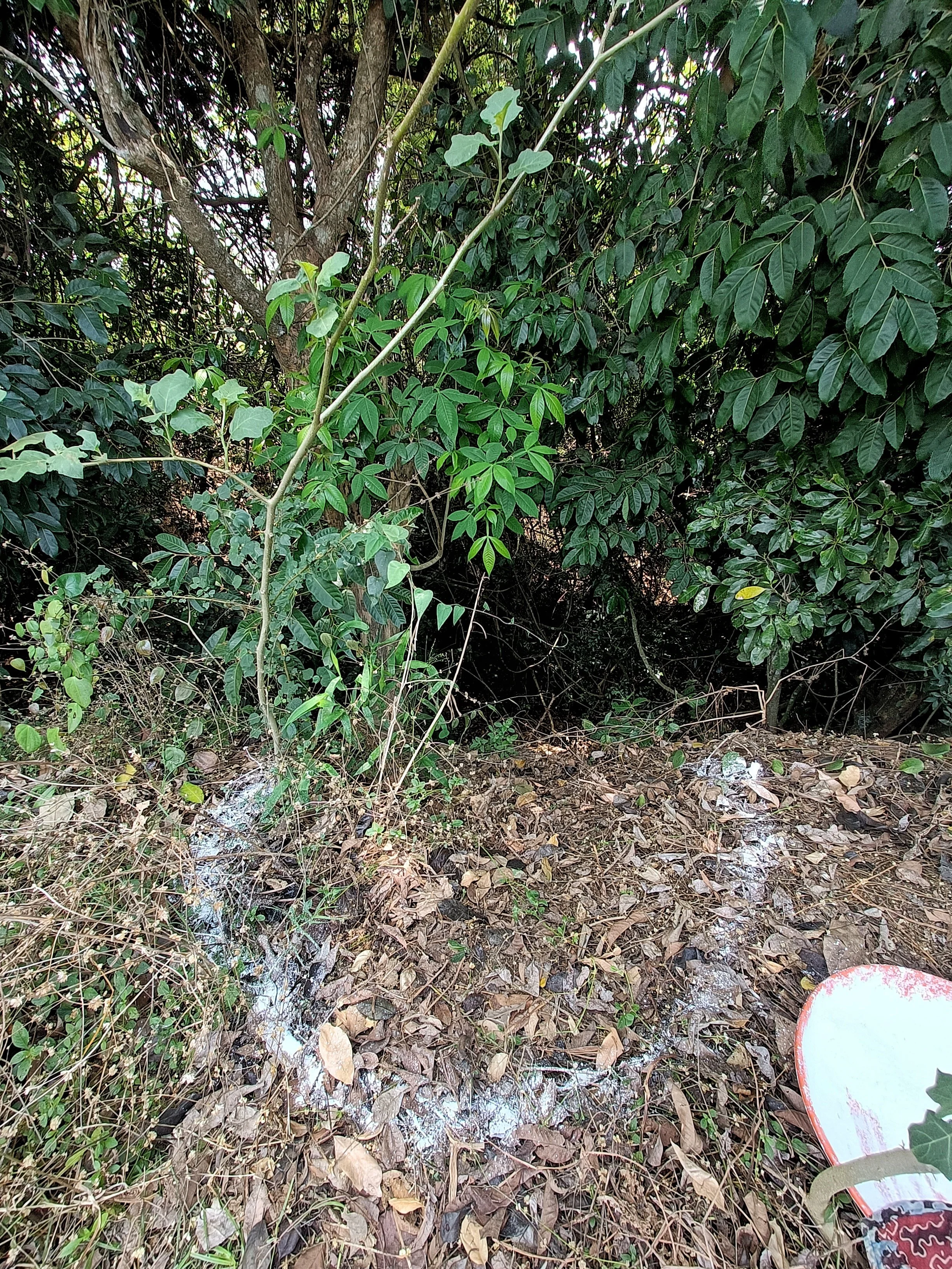
Seating nook (marking) - view into densely vegetated stream for birdwatching
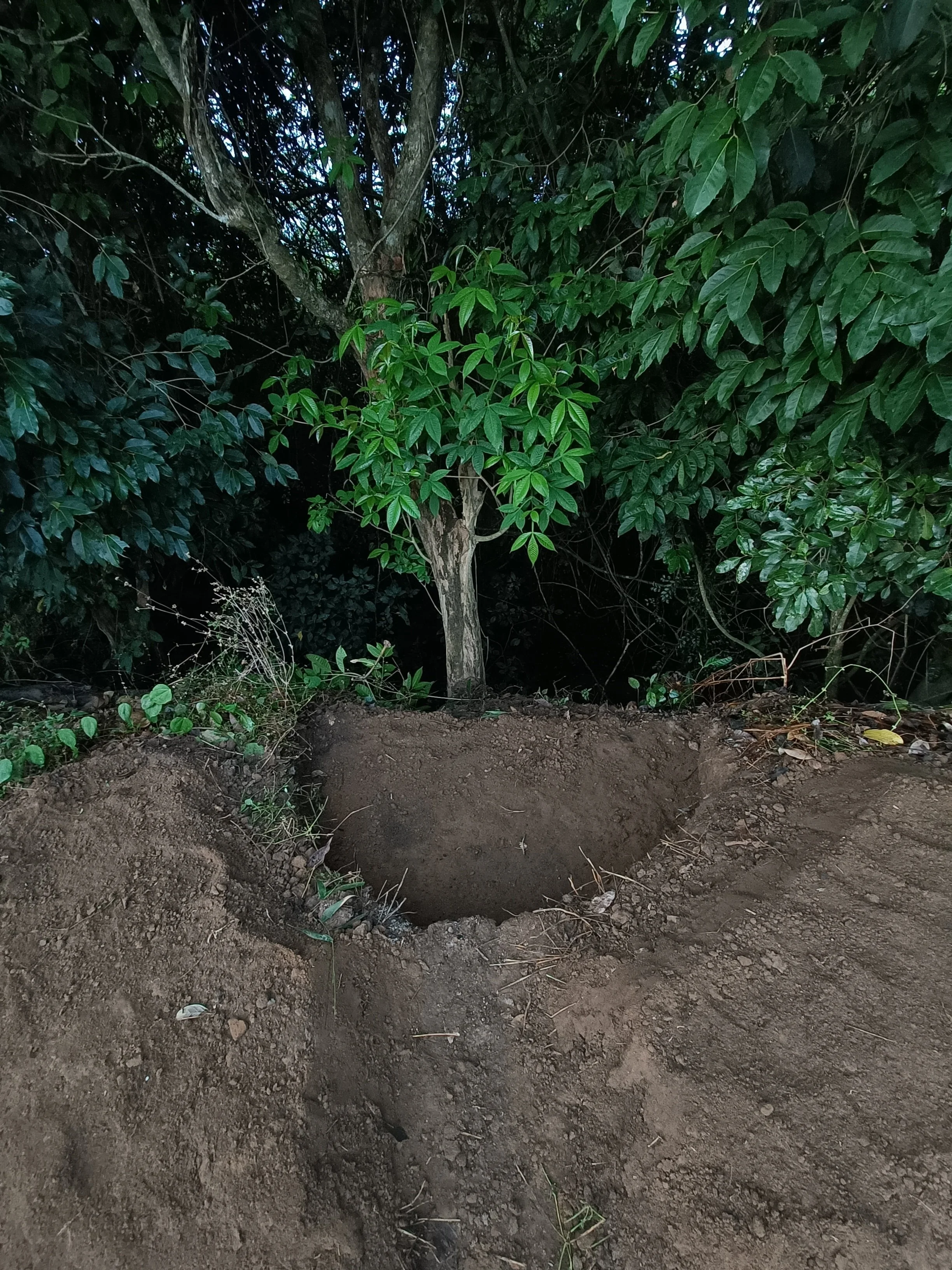
Seating nook - dug and shaped
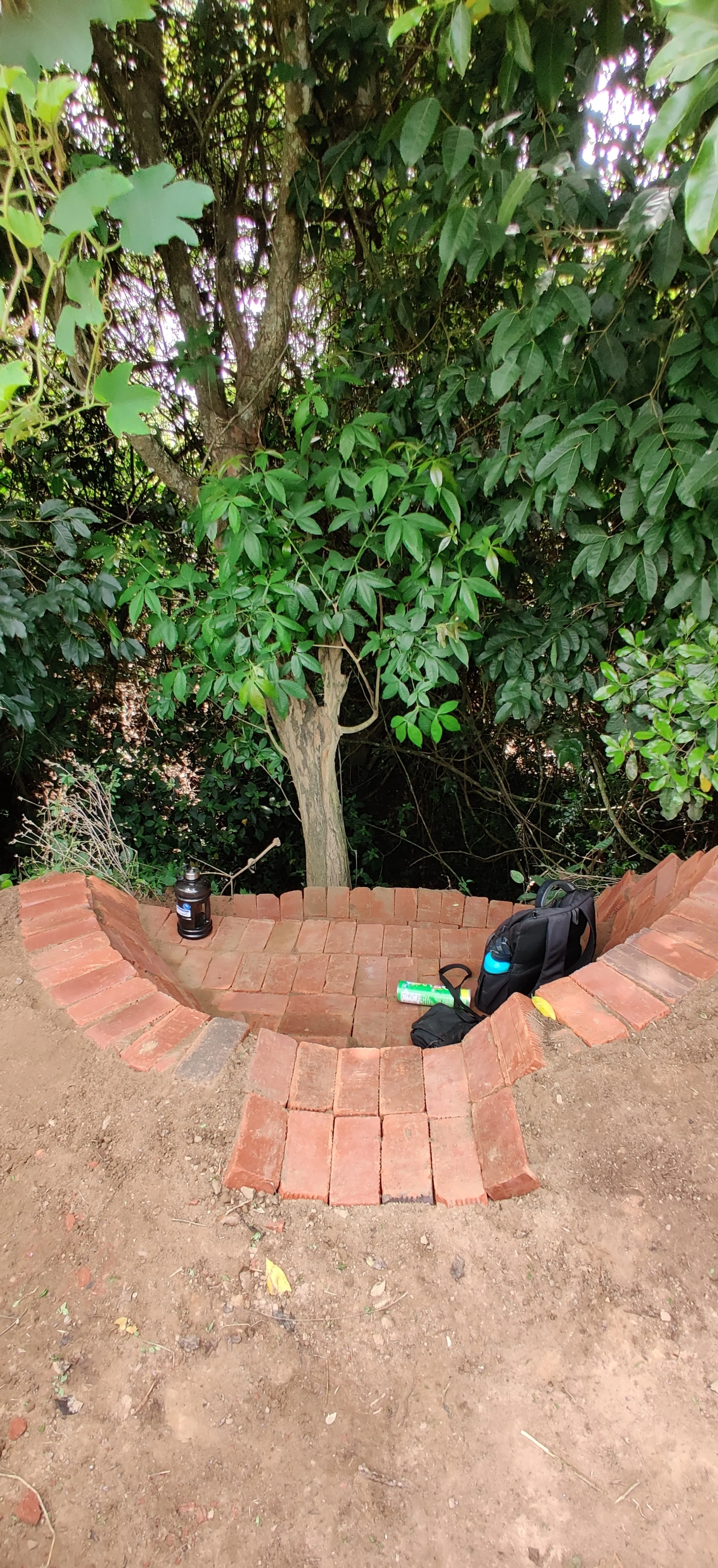
Seating nook - brickwork [photo by Jananee Mohan]
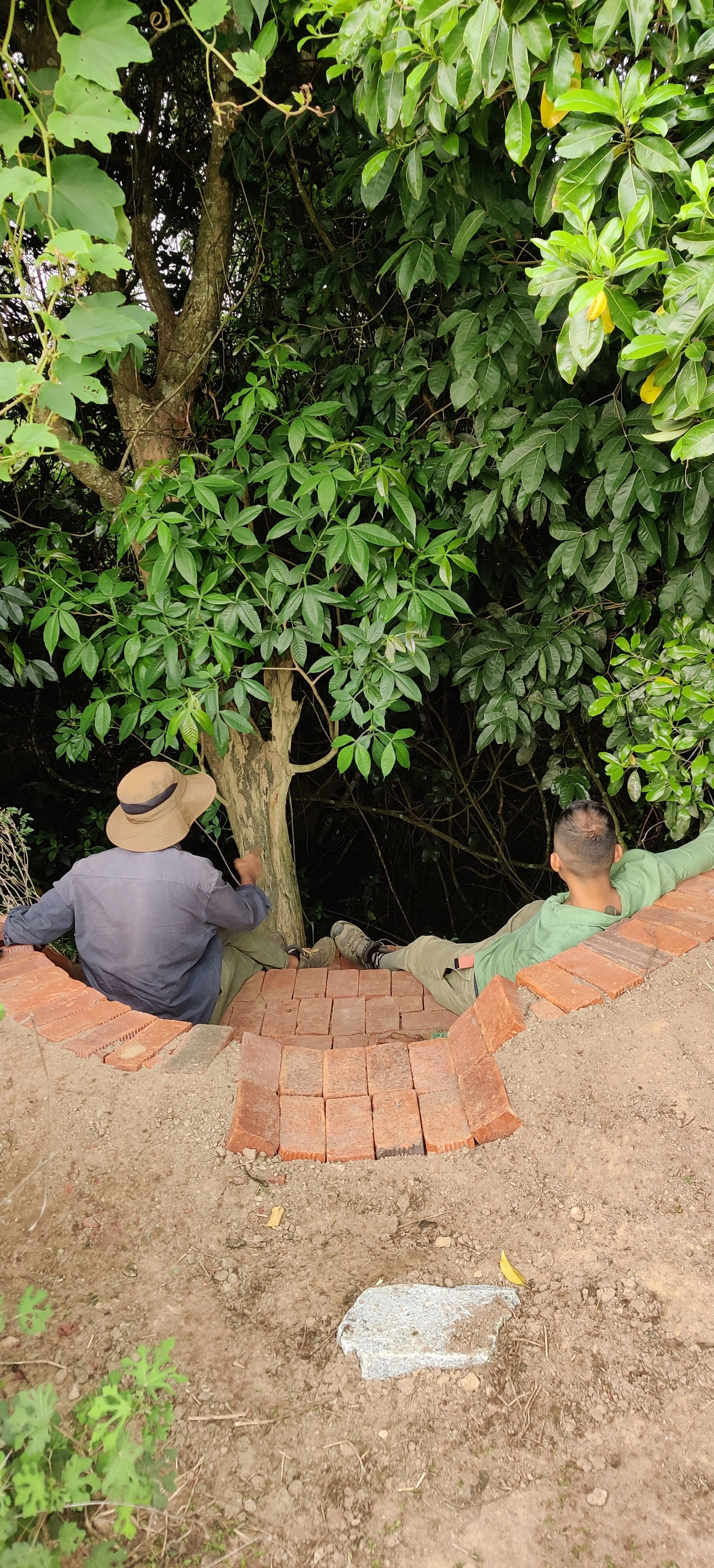
Seating nook - brickwork [photo by Jananee Mohan]
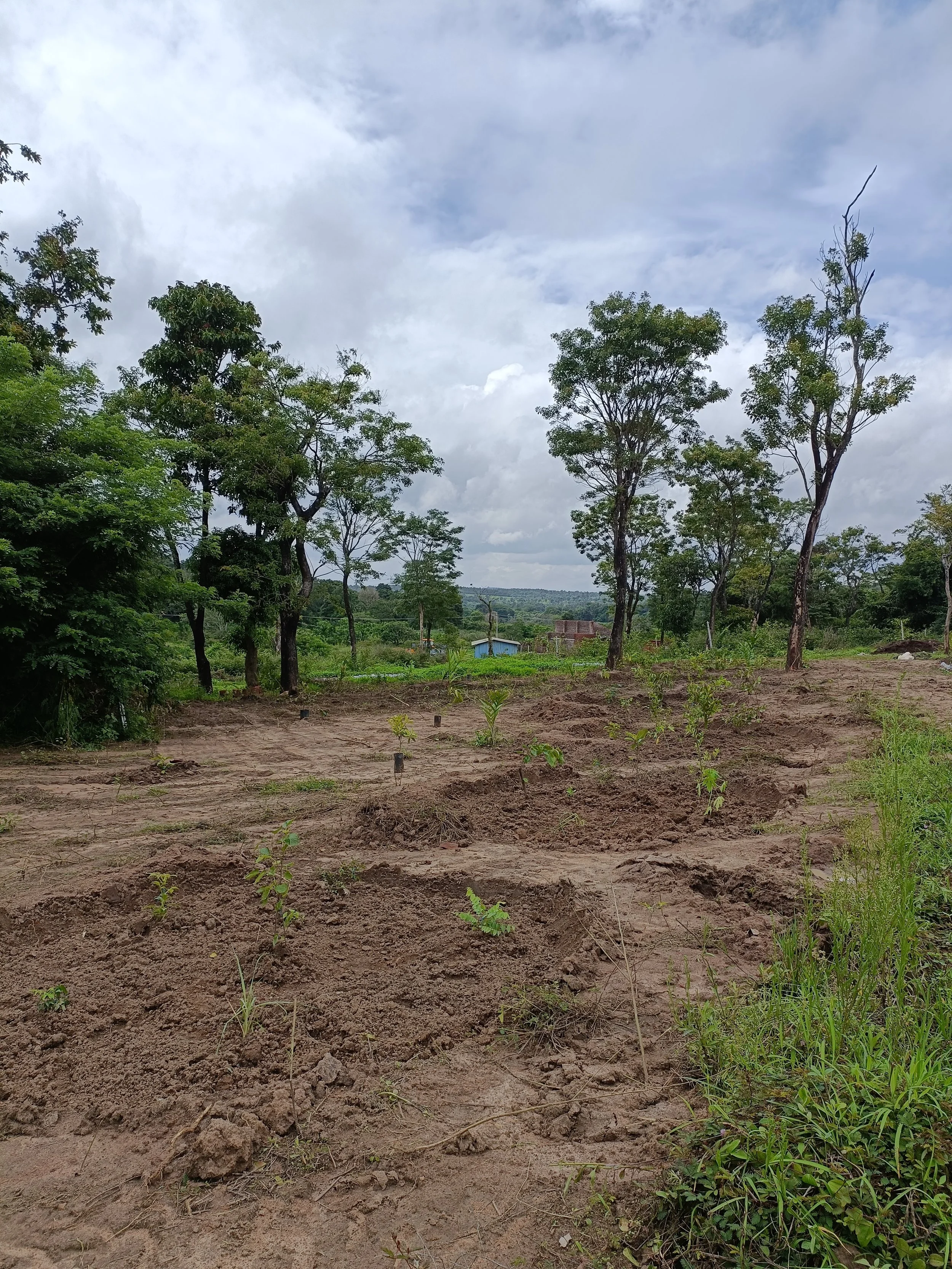
Fruit tree guilds (food forest) - freshly planted
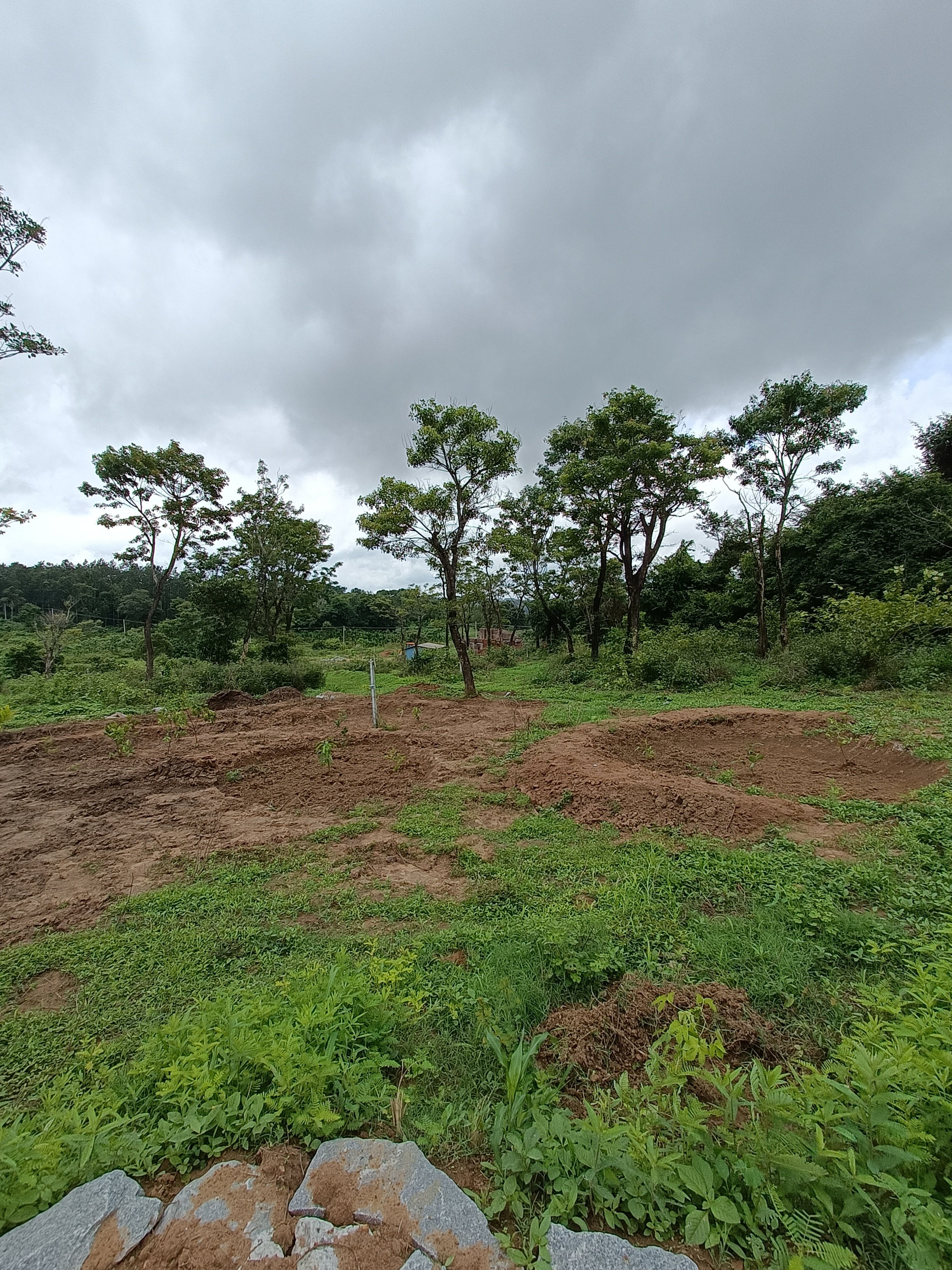
Fruit tree guilds with bunds - freshly planted
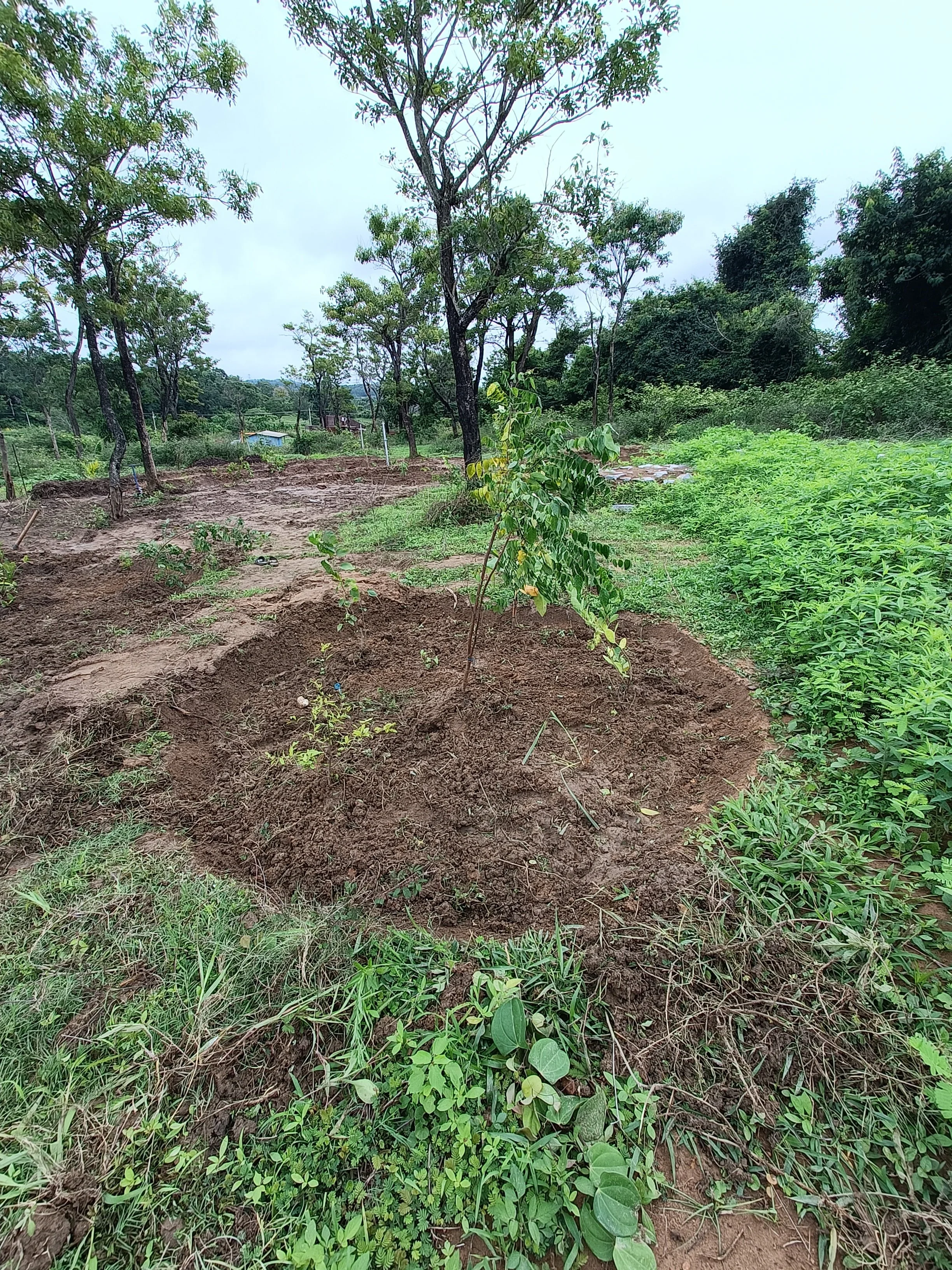
Fruit tree guild - freshly planted
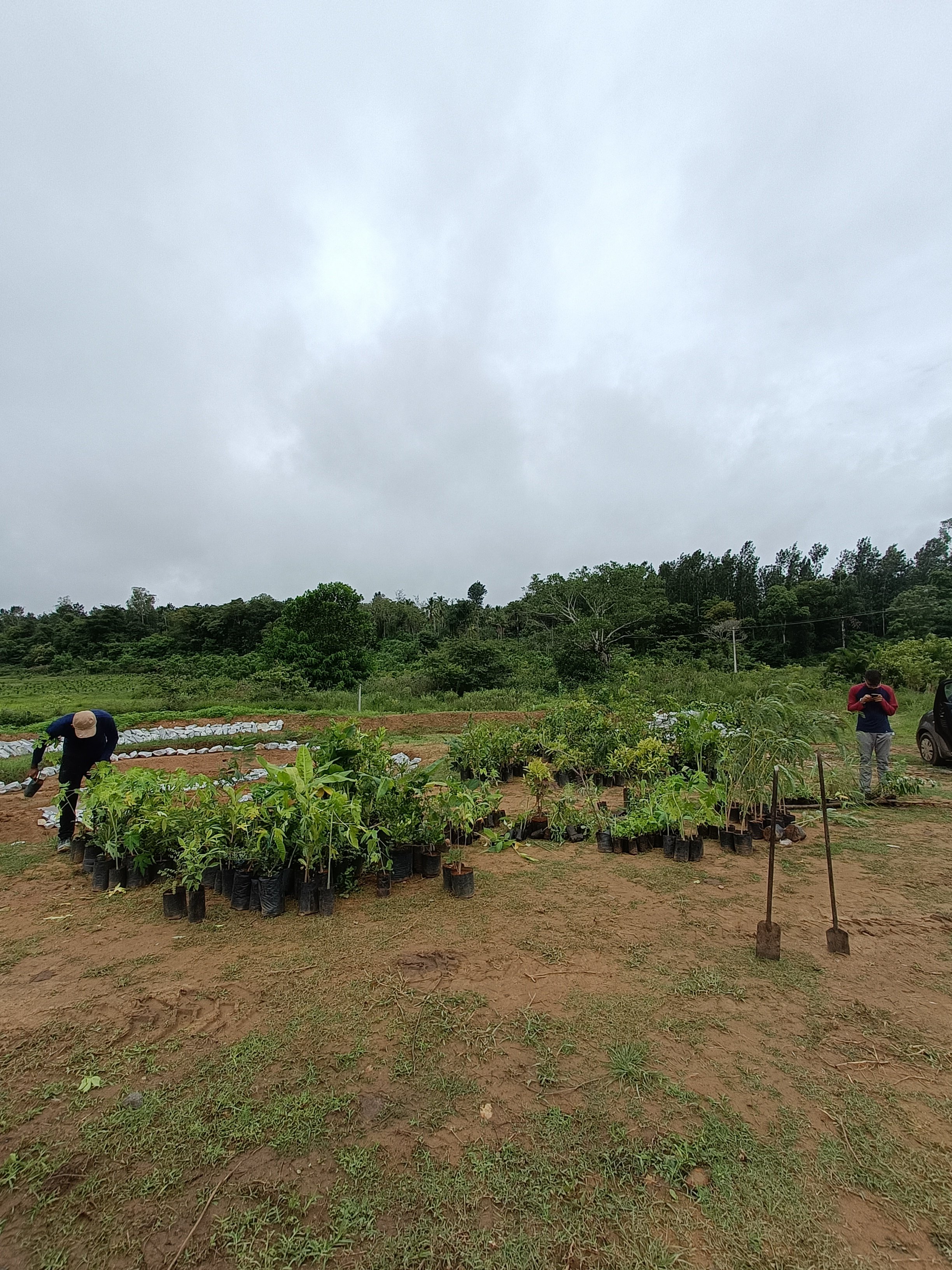
Sorting saplings on site
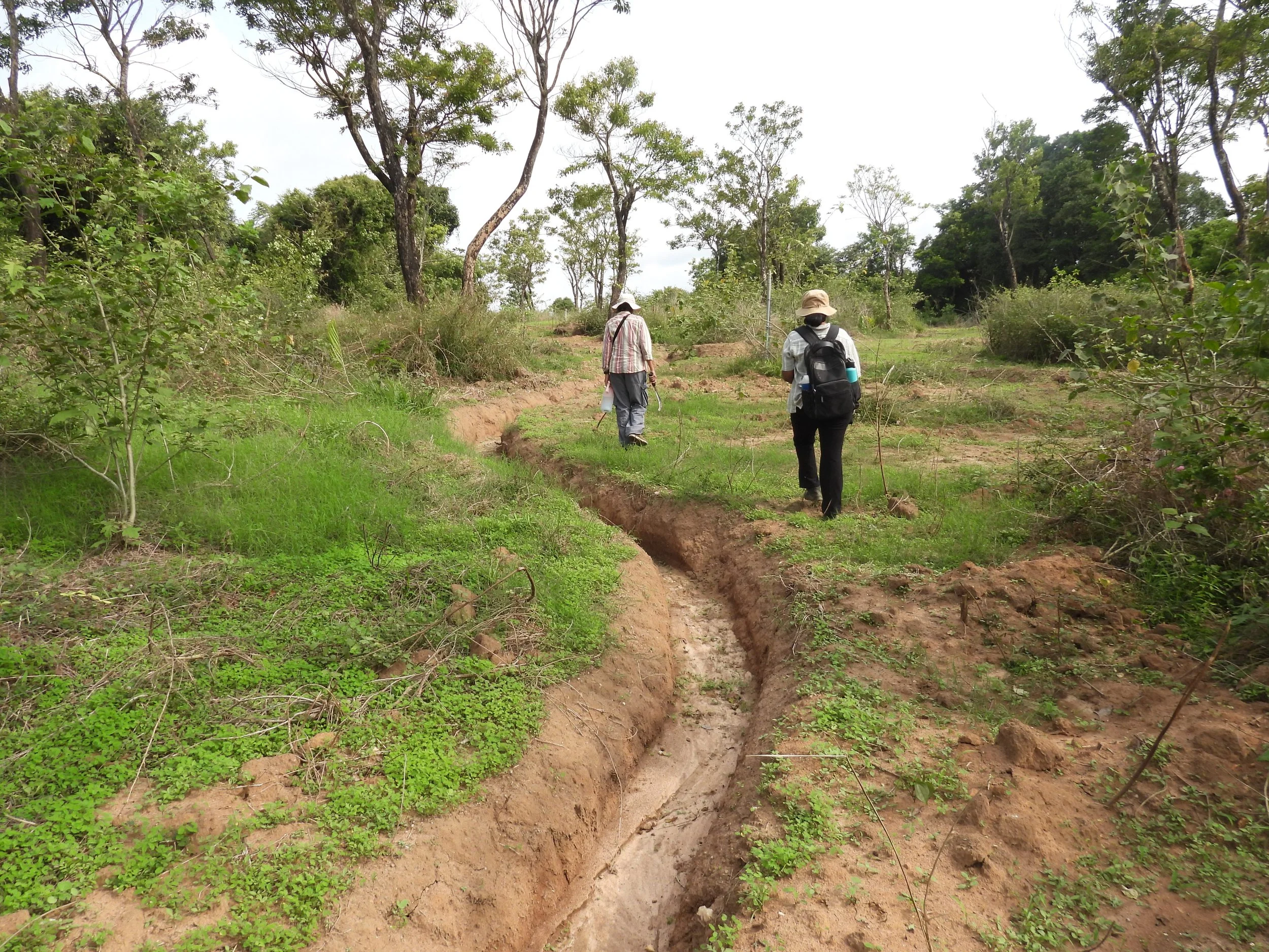
Overflow channels [photo by Jananee Mohan]